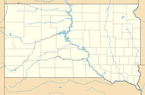
Big Bend dam
| Big Bend dam | ||
|---|---|---|
| location | ||
|
|
||
| Coordinates | 44 ° 2 '58 " N , 99 ° 26' 55" W | |
| country |
|
|
| place | Buffalo and Lyman Counties , South Dakota | |
| Waters | Missouri River | |
| Height upstream | 434 m | |
| power plant | ||
| owner | United States Army Corps of Engineers (USACE) | |
| operator | USACE | |
| construction time | 1959 to 1966 | |
| Start of operation | 1964 | |
| technology | ||
| Bottleneck performance | 494 megawatts | |
| Average height of fall |
21 m | |
| Standard work capacity | 986 million kWh / year | |
| Turbines | Kaplan turbines : 3 × 67.3 MW, 5 × 58.5 MW | |
| Others | ||
The dam Big Bend ( english Big Bend Dam ) is a dam with hydroelectric power plant in the state of South Dakota , USA . It dams the Missouri River , which forms the border between Buffalo and Lyman Counties at this point , to form a reservoir ( Lake Sharpe ). The small town of Fort Thompson is located on the left bank of the river in the immediate vicinity of the dam.
Construction of the dam began in 1959. It was completed in 1964. The dam is primarily used to generate electricity and protect against flooding . It is owned and operated by the United States Army Corps of Engineers (USACE) and is also operated by USACE.
Barrier structure
The barrier structure is an earth embankment dam with a height of 29 m (95 ft ) above the foundation level . The power plant's machine house is on the right-hand side of the river, the weir system with the flood relief on the left. The weir system consists of 8 weir fields.
The dam crest is at an altitude of 434 m (1423 ft) above sea level . The length of the dam crest (including the weir) is 3,222 m (10,570 ft). The maximum width of the dam is 366 m (1200 ft) at the base. The volume of the dam is 13 million m³ (17 million cubic yards ); 412,860 m³ (540,000 cubic yards) of concrete were used.
A maximum of 7645 m³ / s (270,000 cft / s) can be discharged via the flood relief .
Reservoir
At the normal storage target of 433 m (1420 ft), the reservoir extends over an area of around 230.2 km² (56,884 acres ) and holds 2.22 billion m³ (1.8 million acre-feet ) of water; it reaches a length of 129 km (80 miles ). The impoundment began in December 1963; the congestion destination was reached in December 1966.
power plant
The power plant's machine house is on the right side of the dam. The installed capacity of the power plant is 494 MW . The average annual production is 986 million kWh . Of the 8 Kaplan turbines in the power plant, 3 have a maximum of 67.3 MW and the remaining 5 a maximum of 58.5 MW each. The nominal speed of the turbines is 82 / min. The drop height is 21 m (70 ft).
See also
Web links
Individual evidence
- ↑ a b c Big Bend Project Statistics. United States Army Corps of Engineers (USACE), accessed January 2, 2019 .
- ^ Feasibility of introducing cold water fish into Lake Sharpe, South Dakota. (PDF) lib.dr.iastate.edu, p. 2 (8) , accessed on January 2, 2019 (English).
- ↑ Big Bend Dam & Lake Sharpe. USACE, accessed January 2, 2019 .

