Trais Fluors
| Las Trais Fluors | ||
|---|---|---|
| height | 2955 m above sea level M. | |
| location | Canton of Graubünden , Switzerland | |
| Dominance | 0.52 km → Piz da la Funtauna | |
| Notch height | 97 m ↓ Fuorcla Valletta | |
| Coordinates | 782 722 / 156095 | |
|
|
||
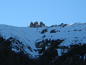
Las Trais Fluors ( ) is a high plateau with three prominent peaks in the Upper Engadin near Celerina . The peaks rise about 100 meters above the plateau. The highest peak is the westernmost, Piz dal Büz ( ) called, with a height of 2955 m above sea level. M.
The name “Las Trais Fluors” is Rhaeto-Romanic and means “The Three Flowers” in German .
The plateau is part of the ski resort Corviglia-Marguns-Piz Nair from St. Moritz in Switzerland . The mountain station of the same name is located at an altitude of 2752 m and can be reached with a six-seater chairlift from the Marguns mountain station ( 2278 m ) in summer as well as in winter. Trais Fluors has three runs of varying difficulty.

