Truman Reservoir
| Harry S. Truman Reservoir Truman Lake (Truman Reservoir) |
|||||||
|---|---|---|---|---|---|---|---|
| Harry S. Truman Dam | |||||||
|
|||||||
|
|
|||||||
| Coordinates | 38 ° 15 '47 " N , 93 ° 24' 17" W | ||||||
| Data on the structure | |||||||
| Lock type: | Gravity dam , earth dam | ||||||
| Construction time: | 1964-1979 | ||||||
| Height above the river bed : | 38.4 m | ||||||
| Building volume: | Earth: 6.5 million m³, concrete: 0.25 million m³ | ||||||
| Crown length: | 1 819 m | ||||||
| Power plant output: | 160 MW | ||||||
| Data on the reservoir | |||||||
| Water surface | 227 km² | ||||||
| Storage space | 6398 million m³ | ||||||
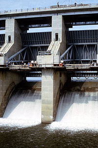
| Two of the four large segment weirs of the flood relief system | |||||||
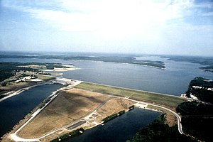
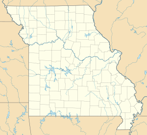
The Harry S. Truman Reservoir (also Truman Lake ) is located in the US state of Missouri .
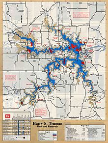
It is the largest man-made lake in Missouri. It lies between Clinton and Warsaw , on the Osage River and extends south to Osceola . The barrier is in Benton County , but the reservoir extends into parts of Henry , St. Clair , and Hickory counties . The dam consists of a 294 m long concrete wall and a 1525 m long earth dam. The flood relief is 58 m long and has four sections.
history
The US Army Corps of Engineers built and operates the dam . Its main purpose is flood protection . Other uses include power generation , recreation, and wildlife.
Originally named Kaysinger Bluff Dam and Reservoir when construction was approved in 1954, the project began in August 1964. It was renamed Harry S. Truman Dam and Reservoir by the United States Congress in 1970 in honor of the Missouri-born former president Harry S. Truman . Construction work was completed in 1979. The name Kaysinger refers to the steep slope just north of the place where the dam was built. The cliff, a popular landmark just in front of the dam, overlooks the confluence of the South Grand River, Tebo Creek, and Osage River. The visitor center stands on this cliff.
The Truman project required many years of planning, land acquisition, expropriations , building new bridges and demolishing old bridges. Various streets, cities, and cemeteries had to be relocated. The first completed construction project was the relocation of Route 13 to a height above the maximum reservoir level.
The reservoir required the closure of the St. Louis - San Francisco Railway (Frisco Railroad) "Highline". Rising water levels cut the railway line at Osceola and Deepwater, and the railway did not want to spend millions relocating the little-used route. The Missouri-Kansas-Texas Railroad moved their main route between La Due and Clinton ; five miles of new track and a combination of causeway and bridge were built over the lake.
Visitor center
In the Harry S. Truman Regional Visitor Center there are exhibitions on the cultural and natural history of Lake Truman, the environmental activities, the construction of the dam, the operation of the power station, and the US Army Corps of Engineers . In a room with 67 seats, films about the flora and fauna, history and safety on the water are shown. From the viewing terrace you can see the reservoir, the barrier structure and parts of the Lake of the Ozarks .
See also
- List of the largest dams on earth
- List of the largest reservoirs on earth
- List of the largest hydroelectric plants in the world
- List of dams in the United States
Web links
- Harry S. Truman Lake, Army Corps of Engineers
- Harry S. Truman State Park
- Area information for Truman Lake
- Explore Missouri
Individual evidence
- ↑ Corps of Engineers "what we do" ( memento of the original from April 1, 2010 in the Internet Archive ) Info: The archive link was inserted automatically and has not yet been checked. Please check the original and archive link according to the instructions and then remove this notice.


