Tschonhar (peninsula)
| Tschonhar | ||
 Tschonhar from 12,000 m altitude |
||
| Geographical location | ||
|
|
||
| Coordinates | 46 ° 3 '40 " N , 34 ° 31' 33" E | |
| Waters 1 | Sea of Azov | |
| Waters 2 | Sywasch | |
| length | ||
| width | ||
| surface | ||
| Remarks | ||
|
|
||
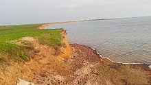
Tschonhar ( Ukrainian Чонгар ; Russian Чонгар / Tschongar ) is an inhabited Ukrainian peninsula in the Sea of Azov . The peninsula is of strategic importance as, in addition to the Arabat Spit and the Isthmus of Perekop , it creates a connection to the Crimea.
geography
The peninsula is located in the northern Sywasch , a large system of shallow bays of the Azov Sea between the Crimean peninsula and the Ukrainian mainland. It divides the Sywasch into an eastern and a western part. In the north the peninsula is connected to the Ukrainian mainland, in the south it is separated from the Crimea by the Chonharska Street ( Чонгарська протока ). Administratively, the Chonhar Peninsula belongs to Henichesk Raion in Kherson Oblast .
There are six villages and two settlements on the peninsula. In addition to the largest village Tschonhar with about 1400 inhabitants, these are Ataman ⊙ , Mykolaivka ⊙ , Novyj Trud ⊙ , Popiwka ⊙ and Chernihiwka ⊙ as well as the two settlements Sywasch ⊙ and Salisnytschne ⊙ , which make up the district council of Tschonhar with a total area of 409.125 km² and about 3100 inhabitants are summarized. The Sevastopol – Kharkiv railway and the M 18 / E 105 highway , which connect mainland Ukraine with Crimea , run across the peninsula .
history
The railway line across the peninsula was built in the 1870s. In 1920 the Red Army succeeded in the Russian Civil War , as well as during the Second World War in November 1943, to penetrate through Chonhar to the Crimea.
In the course of the annexation of Crimea , soldiers penetrated from the Crimea onto the peninsula in March 2014 and set up a checkpoint using weapons . In December 2014, the Russian military withdrew from the peninsula to the Crimea. Since then, the peninsula has been on the border between Ukraine and the Russian-controlled Crimea . On the night of November 22nd, 2015, electricity pylons were blown up near Ataman, through which the power supply to Crimea ran, so that an emergency had to be declared in Crimea.
Web links
Individual evidence
- ↑ Chongar Peninsula on Krim.info ; Retrieved December 11, 2014
- ↑ Chonhar District Council on the official website of the Verkhovna Rada , accessed on December 10, 2014
- ^ Military literature, Perekop and Tschonghar ; Retrieved December 11, 2014
- ↑ on Defense of the Crimean Encyclopedia of the "Great Patriotic War", 1985 ; Retrieved December 11, 2014
- ↑ Russian troops in the territory of the Kherson region, piter-piter.ru of March 9, 2014 ; Retrieved December 11, 2014
- ↑ Near the "Chongar" checkpoint - machine guns against civilians, vladtime.ru of March 8, 2014 ; Retrieved December 11, 2014
- ↑ Russian troops withdrew from Kherson Oblast, on Espreso.tv December 9, 2014 ; Retrieved December 11, 2014
- ↑ No electricity in Crimea in FAZ from November 22, 2015, accessed on November 22, 2015


