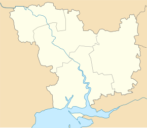
Chornomorka
| Chornomorka | ||
| Чорноморка | ||

|
|
|
| Basic data | ||
|---|---|---|
| Oblast : | Mykolaiv Oblast | |
| Rajon : | Ochakiv district | |
| Height : | 12 m | |
| Area : | 5.5 km² | |
| Residents : | 2,564 (2004) | |
| Population density : | 466 inhabitants per km² | |
| Postcodes : | 57515 | |
| Area code : | +380 5154 | |
| Geographic location : | 46 ° 39 ′ N , 31 ° 30 ′ E | |
| KOATUU : | 4825184801 | |
| Administrative structure : | 1 village | |
| Address: | вул. Суворова 126 57515 с. Чорноморка |
|
| Website : | Website of the district council | |
| Statistical information | ||
|
|
||
Tschornomorka ( Ukrainian Чорноморка ; Russian Черноморка Tschernomorka ; in German "Black Sea") is a village in the south of the Ukrainian Oblast Mykolaiv on the Black Sea coast with about 2500 inhabitants (2004).
The village was called Velykyj Bejkusch ( Великий Бейкуш ) until 1948 and forms its own district council within the Ochakiv Rajon . Chornomorka is located between the Berezan Liman in the northwest, the Black Sea in the southwest, the Ochakiv airfield in the east and the city of Ochakiv in the southeast. The oblast capital Mykolaiv is about 65 km northeast of Chornomorka.
Individual evidence
- ↑ Chornomorka on the official website of the Verkhovna Rada ; Retrieved April 19, 2015

