Tucker Point
| Tucker Point | ||
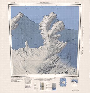
 Topographic map of the Martin Peninsula with Tucker Point (above) |
||
| Geographical location | ||
|
|
||
| Coordinates | 73 ° 57 ′ S , 114 ° 49 ′ W | |
| location | Marie Byrd Land , West Antarctica | |
| coast | Bakutis coast | |
| Waters | Glade Bay | |
The Tucker Point is an ice-covered headland at the Bakutis Coast of the West Antarctic Marie Byrd lands . It is located 19 km southwest of Cape Herlacher on the west side of the Murray Foreland , the northwest branch of the Martin Peninsula .
The United States Geological Survey mapped the headland on the basis of own surveys and aerial photographs of the United States Navy in the years from 1959 to 1967. The Advisory Committee on Antarctic Names renamed it in 1977 after the meteorologists Robert L. Tucker, who until 1976 at nine campaigns of the operation Deep Freeze was involved.
Web links
- Tucker Point in the Geographic Names Information System of the United States Geological Survey (English)
- Tucker Point on geographic.org (English)
