Murray Foreland
| Murray Foreland | ||
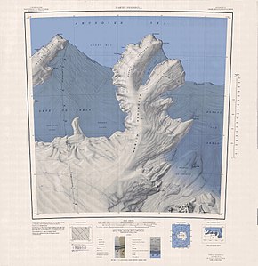
 Topographic map of the Martin Peninsula with the Murray Foreland (top left) |
||
| Geographical location | ||
|
|
||
| Coordinates | 74 ° 0 ′ S , 114 ° 30 ′ W | |
| Waters 1 | Amundsen Sea , Southern Ocean | |
| length | 30 km | |
| width | 16 km | |
The Murray Foreland is an icy, 30 km long and 16 km wide peninsula on the Bakutis coast of the West Antarctic Marie Byrd Land . It forms the northwest branch of the Martin Peninsula .
The United States Geological Survey first mapped the headland using aerial photographs taken by the United States Navy during Operation Highjump (1946–1947) in January 1947. The Advisory Committee on Antarctic Names named it after the US geologist Grover Elmer Murray (1916–2003 ), served on the Board of Directors of the National Science Foundation from 1964 and President of Texas Tech University from 1966 to 1976 .
Web links
- Murray Foreland in the Geographic Names Information System of the United States Geological Survey (English)
- Murray Foreland on geographic.org (English)
