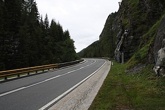
Twenger valley pass
| Twenger Talpass ( valley pass ) |
|||
|---|---|---|---|
|
Twenger valley pass |
|||
| Compass direction | North | south | |
| height | 1381 m above sea level A. | ||
| region | Salzburg , Austria | ||
| Waters | Southern Taurach | ||
| Valley locations | Obertauern | Tweng | |
| expansion | Katschberg Strasse (B99) | ||
| Mountains | Radstadt Tauern | ||
| map | |||
|
|
|||
| Coordinates | 47 ° 12 '29 " N , 13 ° 35' 9" E | ||
The Twenger Talpass (also called Tauern Wacht ) is 1381 m above sea level. A. high valley pass in the west of the Radstädter Tauern . It is located in the Lungau Taurach Valley between Mauterndorf and Obertauern in the state of Salzburg in Austria .
history
A first fortification is mentioned here in a document in 1258. At that time there was a war between Archbishop Ulrich and the Elect Philipp von Spanheim , during whose Archbishop Ulrich had a festival house built by Holzwerk on the Tauern . However, this facility was overrun by the Carinthian attackers. This is why the wooden fortress was probably replaced by a stone structure in the 13th century.
The facility was also important during the Hungarian War (1479–1490). At that time, a Habsburg-Imperial army plundered Mauterndorf and the Lungau , but did not take the route over the Tauern to Salzburg . After that, this was only a fortification in Salzburg without any major significance. It was therefore left to decay. On the uphill side of the road, however, a block house was built that served as a toll and customs post. But this log house also served as a base for the path makers, because they had to be on the spot quickly to free people, animals and vehicles from the snow masses when an avalanche broke out.
During the first penetration of the French in 1797 enemy soldiers could be repulsed by farmers and miners. The former wooden bridge was torn down and prepared stone avalanches fell on the enemy. In 1826 a new stone bridge was built here.
Both systems have almost completely disappeared today due to the road expansion. Before the Katschtal federal road was built, an inventory was carried out again. This resulted in three towers surrounded by a low wall, the crowns of which stood 40 m above the old street level. The walls were still 2.5 m upright; the outer clearances of the towers were 11.2 × 11.2 m, the inner clearances 6 × 6 m. A still existing square weir system lies on a spur of the terrain below the old street. This is likely to have been the fourth tower that was defensive against the Lungau.
literature
- Friederike Zaisberger & Walter Schlegel : Castles and palaces in Salzburg. Pongau, Pinzgau, Lungau . Birch series, Vienna 1978, ISBN 3-85030-037-4 .


