US Interior Highlands
| US Interior Highlands
Interior highlands
|
||
|---|---|---|
| Highest peak | Mount Magazine ( 839 m ) | |
| location |
Arkansas , Missouri , Oklahoma , Kansas , United States |
|
|
|
||
| Coordinates | 35 ° 36 ′ N , 93 ° 22 ′ W | |
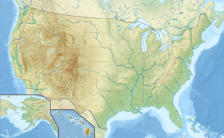
The US Interior Highlands is a mountainous region in the states of Arkansas , Missouri, and Oklahoma in the United States . They are the only mountainous region of note in the United States between the Rocky Mountains to the west and the Appalachians to the east.
geography
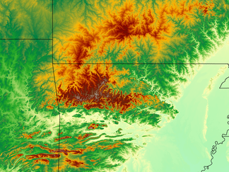
The Interior Highlands can be divided into three larger topographical units: the Ouachita Mountains in southeastern Oklahoma and western central Arkansas, the Ozark Plateau in southern Missouri and northern Arkansas (the outermost edge extends into southeastern Kansas ) and the one enclosed by both Arkansas Valley .
Ozark Plateau
In contrast to the Ouachita Mountains, the Ozark Plateau is the result of an extensive uplift so that the rock layers are relatively horizontal. The core of the Ozarks are the Saint Francois Mountains with a height of almost 610 meters. To the south of the Ozark Plateau, the Boston Mountains rise to a height of up to 760 m , which is the highest point on the plateau.
Arkansas Valley
The Arkansas Valley is enclosed between the Ozark Plateau in the north and the Ouachita Mountains in the south. It was created in the course of the formation of the Ouachita Mountains through a subsidence of the rock, so it is not a valley created by erosion , but a structural hollow. It is up to 65 km wide and at its edges to the Ozark Plateau merges into cut plateaus, which are similar to those of the Ozark Plateau, but are lower down. In the south it turns into the Ouachita Mountains in mountain ridges formed by folding .
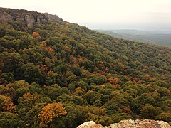
Geographical features of the Arkansas Valley are solitary mesas with flat tops like Mount Magazine , the highest point in the Interior Highlands at 839 m . The summit is about 670 feet above the lowlands of the Arkansas Valley. The steep slopes of the table mountains were created by erosion by the Arkansas River .
Ouachita Mountains
The Ouachita Mountains were formed during the Carboniferous approximately 300 million years ago. When Gondwana collided with today's North America, the Appalachians were initially created. This event later set off the folds and faults in Pennsylvania that led to the formation of the Ouachita Mountains. This collision running in north-south direction produced the mountains expanding in east-west direction. This east-west extension of the Ouachita Mountains is quite unusual in North America, as most mountains such as the Rocky Mountains or the Appalachians run in a north-south direction.
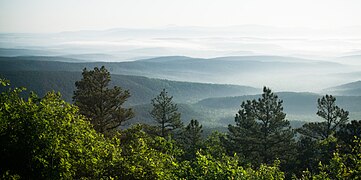
The rounded peaks speak for the age of the mountains. The lack of weather-resistant rock and 300 million years of weathering and erosion have caused the once taller peaks of the Ouachita Mountains to become blunted similar to that of the Appalachians today.
Individual evidence
- ↑ a b c d modis.gsfc.nasa.gov: December 16, 2019 - Central Interior Highlands , accessed on April 9, 2020 (English)
- ↑ a b c d e f g h teacherfriendlyguide.org: Region 2: The Interior Highlands , accessed on April 9, 2020 (English)


