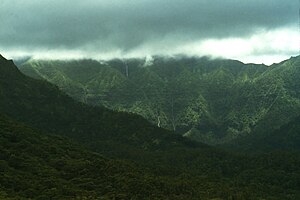
Waiʻaleʻale
| Waiʻaleʻale | ||
|---|---|---|
|
The cloud-covered summit |
||
| height | 1569 m | |
| location | Kauaʻi , Hawaii , USA | |
| Coordinates | 22 ° 4 '26 " N , 159 ° 29' 55" W | |
|
|
||
The Waiʻaleʻale ( German mostly Waialeale ) is a shield volcano and after the Kawaikini the second highest mountain on the island of Kauaʻi in Hawaii . The name means "rippling" or "overflowing water" in the Hawaiian language .
The summit of the 1569 meter high Waiʻaleʻale is covered by clouds all year round. Very even, moist, northeast trade winds hit the steep northeast flank of the mountain, the slopes of which have an average incline of over 110%. This creates rising slope winds , with the abundant water it contains raining down as incline rain.
Since this weather is very stable, it rains 335 days a year, with large amounts of rain falling constantly on a very small area. Together this results in an enormous average annual rainfall of around 12,000 mm, with a record of 17,300 mm in 1982. This makes the northeast flank of the Waiʻaleʻale one of the rainiest places on earth.
Due to the tropical climate, the vegetation on the northeast side consists of tropical rainforest and - on a plateau near the summit - the Alaka'i swamps . The latter are part of a nature reserve that is largely inaccessible to the public .
Web links
- Waiʻaleʻale on Peakbagger.com (English)
- Waiʻaleʻale in the Geographic Names Information System of the United States Geological Survey


