
Wankhaus
| Wankhaus DAV hut category II |
||
|---|---|---|
 Wankhaus from the south |
||
| location | on the Wank summit , east-northeast of Garmisch-Partenkirchen ; Bavaria , Germany | |
| Mountain range | Ester Mountains | |
| Geographical location: | 47 ° 30 '30 " N , 11 ° 8' 36" E | |
| Altitude | 1780 m above sea level NN | |
|
||
| owner | DAV - Garmisch-Partenkirchen Section | |
| Built | 1911 | |
| Construction type | hut | |
| Development | accessible with the Wankbahn | |
| Usual opening times | all year round from 11 a.m. to 3 p.m. | |
| accommodation | 10 beds, 20 camps | |
| Web link | Website of the section | |
| Hut directory | ÖAV DAV | |

The Wankhaus (also Alois-Huber-Haus ) is located at 1780 m in the Estergebirge in the Bavarian Prealps on the summit of the Wank . The hut is managed almost all year round by the Garmisch-Partenkirchen section of the German Alpine Club .
history
As early as 1894, the general assembly of the Garmisch-Partenkirchen section of the DuÖAV was concerned with the construction of a shelter on the summit of the Wank. In the following years the tourist value of the Wank increased further and at the latest after the erection of a summit cross on the Wank summit by the folk costume association "Werdenfelser Heimat" in 1904, the number of visitors increased to such an extent that the topic of hut construction was further promoted by the section.
On the other hand, there were repeated setbacks in the negotiations with the landowner, the development of a suitable drinking water supply and the financing of the construction, for example the Garmisch loan fund association refused a loan and the main committee of the DuÖAV a fixed subsidy. The schedule, the scope of the project and the construction plans had to be changed again and again until the section board finally decided on the construction in 1909. Initially, there was no water pipe. Alois Huber, at that time treasurer and hut referee of the section and already a driving force in the planning phase, was a wood carver by profession, designed the interior and had it made cheaply in his workshop. The construction sum of almost 25,000 marks was financed from the income from the path through the Höllentalklamm, which is managed by the section. Construction work began in the summer of 1910 and the Wankhaus was ceremoniously opened in May of the following year.
The hut enjoyed great popularity after the war and, not least due to the construction of the Wank cable car , the first extensions were necessary in 1929/30, whereby the previously neglected water supply was also taken into account. Another extension followed in 1939.
Since 1958 there has been a measuring station of the Fraunhofer Institute in the immediate vicinity of the hut, in which data for investigating radioactivity in the air and for measuring precipitation is collected. In 1960 the Garmisch-Partenkirchen section acquired the property on which the Wankhaus stands for 52,000 DM from the Bavarian Forest Administration and has since been the owner of the area on the Wank summit.
Surname
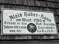
The refuge was built under the name Wankhaus. After Alois Huber, who was crucially involved in building the hut, died in 1922, the Section gave it the nickname Alois-Huber-Haus in order to honor Huber's services . Officially, however, the accommodation is listed under the name Wankhaus in the DAV publications. Today there are signs with both names on the hut.

Hut sign Wankhaus
Hut sign Alois-Huber House


Accesses
The hut can be reached:
- from the summit station of the Wank-Bahn ( 1780 m ), which is only about fifty meters from the hut,
- from Garmisch-Partenkirchen ( 700 m ) via the Eckenhütte in approx. 2½ hours or via the Daxkapelle and the Esterbergalm in approx. 3 hours,
- from Farchant ( 671 m ) in a walking time of approx. 3 hours,
Tours
- Crossing to the Weilheimer Hütte ( 1955 m ), walking time 3-3½ hours, from there in 30 minutes to the Krottenkopf ( 2086 m )
- Ascent of the Hoher Fricken summit ( 1940 m ), walking time 1½-2 hours
- Ascent to the Bischof summit ( 2033 m ), walking time 2-2½ hours
literature
- Dieter Seibert: Zugspitze. With Ammergauer Alpen and Werdenfelser Land , Bergverlag Rother , Ottobrunn 2012, ISBN 978-3-7633-4264-8
- Maps: Topographic map - Karwendel Mountains, Werdenfelser Land , Bavarian State Surveying Office, scale 1: 50,000
Individual evidence
- ↑ A rocky but successful path: 100 years of Wankhaus. Merkur-Online, accessed on September 3, 2014 .
- ↑ Festschrift for the 25th anniversary of the Garmisch-Partenkirchen section. (PDF, pages 37–39) DuÖAV section Garmisch-Partenkirchen, accessed on September 3, 2014 .
- ^ News sheet of the Garmisch-Partenkirchen section of the DAV. (PDF, page 15) DAV section Garmisch-Partenkirchen, accessed on September 3, 2014 .
- ↑ 100 years of the Garmisch-Partenkirchen AV Section. (PDF, page 109) DAV section Garmisch-Partenkirchen, accessed on September 3, 2014 .