Wank (mountain)
| Wank | ||
|---|---|---|
|
View from the Loisach valley to the Wank |
||
| height | 1780 m above sea level NN | |
| location | Bavaria | |
| Mountains | Estergebirge , Bavarian Prealps | |
| Dominance | 2 km → Hoher Fricken | |
| Notch height | 495 m ↓ saddle to Hohen Fricken | |
| Coordinates | 47 ° 30 '39 " N , 11 ° 8' 26" E | |
|
|
||
| rock | Main dolomite , west side mainly limestone | |
| Age of the rock | Triad | |
| Development | since 1928 by cable car | |
|
Paraglider pilot started from Wank in front of the Wetterstein Mountains |
||
The Wank is a mountain in the southwest of the Estergebirge near Garmisch-Partenkirchen with a height of 1780 m above sea level. NN . The name goes back to an old word for "slope"; the mountain was formerly called the Eckenberg .
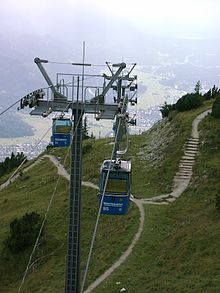
Since 1928, the Wank has been accessible with a cable car , the Wankbahn , from Garmisch-Partenkirchen. In 1982 the old Wankbahn was replaced by a modern circulating gondola lift. The Wankhaus (Alois-Huber-Haus), which is managed almost all year round , was built by the Garmisch-Partenkirchen section of the German Alpine Club in 1911.
The Wankaufstieg is an easy hike with no particular difficulties. In addition to the ascent near the cable car, there are also ascent options from the swimming pool in Farchant via the Esterbergalm or from the Gschwandtner farmer (east of Garmisch-Partenkirchen on the road towards Mittenwald ). At the summit there is an outstanding view. The Wank is also a good starting point for a flight with a paraglider in a southerly direction over the Garmisch-Partenkirchen valley to the summits of the Wetterstein Mountains . A rewarding high path on the west side of the mountain is the Hüttelsteig, which leads from the middle station of the Wankbahn to the Esterbergalm.
There used to be a small ski area on the northeast side, which has been closed since 2003/2004. The former four ski lifts have largely been dismantled, the slopes are growing over.
Web links
Individual evidence
- ^ Bavarian Geological State Office, 1998, Geological map of Bavaria with explanations 1: 500,000
- ↑ Wank ski area on Skiwelt.de


