Wannebach (Lenne)
| Wannebach | ||
|
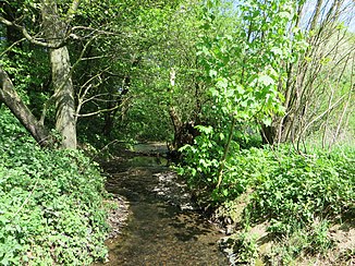
The Wannebach in the forest area between Wannebachstrasse and Westheide |
||
| Data | ||
| Water code | DE : 2766996 | |
| location |
Süderbergland
|
|
| River system | Rhine | |
| Drain over | Lenne → Ruhr → Rhine → North Sea | |
| source | northwest of Iserlohn - Stübbeken 51 ° 22 ′ 59 ″ N , 7 ° 35 ′ 20 ″ E |
|
| Source height | approx. 238 m above sea level NHN | |
| muzzle | southwest of Hagen - Berchum in the Lenne Coordinates: 51 ° 22 ′ 44 ″ N , 7 ° 32 ′ 2 ″ E 51 ° 22 ′ 44 ″ N , 7 ° 32 ′ 2 ″ E |
|
| Mouth height | approx. 106 m above sea level NHN | |
| Height difference | approx. 132 m | |
| Bottom slope | approx. 21 ‰ | |
| length | 6.2 km | |
| Catchment area | 8.775 km² | |
| Discharge A Eo : 8.775 km² at the mouth |
MNQ MQ Mq |
14.92 l / s 105.7 l / s 12 l / (s km²) |
The Wannebach is a six-kilometer-long flowing water in the area of the independent city of Hagen in North Rhine-Westphalia and it is an eastern and right tributary of the Lenne .
geography
course
The Wannebach rises in the Schälker Heide in the Iserlohn district of Letmathe at an altitude of about 238 m above sea level. NHN .
It then flows through the nature reserves Oberes Wannebachtal and Unteres Wannebachtal and finally flows from the east to the Lenneaue Berchum at an altitude of about 106 m above sea level. NHN from the right into the Lenne .
The approximately 6.2 km long course of the Wannebach ends approximately 132 meters below its source, so it has a mean bed gradient of approximately 21 ‰.
Catchment area
The 8,775 km² catchment area of the Wannebach lies in Lower Sauerland and is drained through it via the Lenne, Ruhr and Rhine to the North Sea.
It borders
- in the northeast to the catchment area of the Lollenbach , which drains over the Elsebach into the Ruhr
- in the southeast to that of the Flehmer Bach , which flows into the Lenne
- in the south to that of the Lenne tributary Hasselbach
- in the north-west to that of the old Ruhr trench
- and in the north to that of the Wannebach , which also flows into the Ruhr
Tributaries
- Hülsbach ( left ), 0.4 km
- Elsebach left ), 1.7 km
- Golfbach ( left ), 0.8 km
- Ostenbach ( right ), 0.3 km
- Rehbergs Bach ( left ), 0.9 km
- Hunkebach ( left ), 2.7 km
Web links
Individual evidence
- ↑ Martin Bürgener: Geographical Land Survey: The natural spatial units on sheet 110 Arnsberg. Federal Institute for Regional Studies, Bad Godesberg 1969. → Online map (PDF; 6.1 MB)
- ↑ a b Topographical Information Management, Cologne District Government, Department GEObasis NRW ( Notes )
- ↑ a b ELWAS specialist information system, Ministry for Climate Protection, Environment, Agriculture, Nature and Consumer Protection North Rhine-Westphalia ( notes )
- ↑ a b c d own measurement on ELWAS
