Cahua hydropower plant
| Cahua hydropower plant | |||
|---|---|---|---|
| location | |||
|
|
|||
| Coordinates | 10 ° 34 ′ 25 ″ S , 77 ° 18 ′ 47 ″ W | ||
| country |
|
||
| place | Lima region | ||
| Waters | Río Pativilca | ||
| Data | |||
| power | 43 MW | ||
| operator | Statkraft | ||
| Start of operations | 1967 | ||
| turbine | 2 Francis turbines | ||
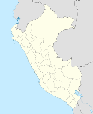
The Cahua hydropower plant (Spanish: Central Hidroeléctrica Cahua ) is located on the Río Pativilca in the central west of Peru , 170 km north of the state capital Lima . The power plant is located in the Manás district in the Cajatambo province of the Lima administrative region .
The hydropower plant is located in the Peruvian Western Cordillera about 60 km from the Pacific coast. It is located at an altitude of 880 m on the left bank of the Río Pativilca. The settlement of Cahua is 3.5 km southwest of the facility. The power plant was commissioned in November 1967. In 2003, SN Power Perú took over the plant. The power plant has been operated by Statkraft since 2014 . The power plant has been controlled from a control room in Lima since the mid-2010s.
The hydropower plant has two vertically directed Francis turbines . The installed capacity is 43 MW. The average annual energy production is 290 GWh. The power plant uses a drop height of 219 m. The expansion water volume is 22 m³ / s.
There is a weir ( ⊙ ) on the Río Pativilca 12 kilometers upstream . Below this, part of the river water is diverted and fed to the power plant via an approximately 10 km long underground water pipe.
![]() Map with all coordinates: OSM | WikiMap
Map with all coordinates: OSM | WikiMap
Individual evidence
- ↑ a b c d Central Hidroeléctrica Cahua . Force. Retrieved September 7, 2019.
