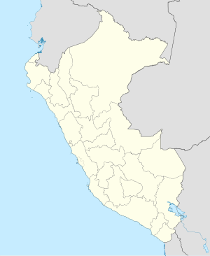
Carhuaquero hydroelectric power station
| Carhuaquero I – III hydropower plant | |||
|---|---|---|---|
| location | |||
|
|
|||
| Coordinates | 6 ° 36 '42 " S , 79 ° 14' 22" W | ||
| country |
|
||
| place | Cajamarca region | ||
| Waters | Río Chancay | ||
| Data | |||
| power | 95 MW | ||
| operator | Orazul Energy Perú SA | ||
| Construction time: | 1980-1991 | ||
| Start of operations | 1991 | ||
| turbine | 3 Pelton turbines | ||
The Carhuaquero hydropower plant (Spanish Central Hidroeléctrica Carhuaquero ) is located on the Chancay River in northwest Peru , 650 km north-northwest of the state capital Lima . The power plant is located in the Llama district in the Chota province of the Cajamarca administrative region . It consists of 5 units that are spread over three locations. The systems are remotely controlled from a control room in Chiclayo . The installed capacity of the Carhuaquero I – V power plant network is 111 MW, the annual energy production is estimated at 620 GWh.
Carhuaquero Hydroelectric Power Plant (Units I-III)
The Carhuaquero hydropower plant is located in the Peruvian Western Cordillera around 70 km from the Pacific coast. It is located at an altitude of 377 m on the left bank of the Río Chancay. The construction of the power plant began in 1980 by Electroperú. Financing problems meant that the plant could not be put into operation until 1991. In 2016, the corporation I Squared Capital took over the power plant from Duke Energy . Since then, the plant has been operated by Orazul Energy Perú SA.
The hydropower plant has three vertically directed Pelton turbines . Their total output was increased from 75 MW to 95 MW in 1998. The power plant uses a net drop height of 475 m. The expansion water volume is 22 m³ / s.
Cirato dam
The Cirato dam (Spanish: Presa Cirato ⊙ ) is located 13.5 kilometers upstream on the Río Chancay. It consists of a 33 m high concrete dam. The storage volume is 350,000 m³. The flood relief system has a capacity of 1000 m³ / s. A large part of the river water is drained off below the dam. The water is led to the power plant via a 13.5 km long tunnel and a subsequent approximately 1000 m long pressure pipe. The substation ( ⊙ ) is located about 900 m from the power station building.
Carhuaquero IV hydropower plant
The Carhuaquero IV ( ⊙ ) hydropower plant was built in 2007 to complement the existing hydropower plant. It only operates 5 months a year during the rainy season. It has a vertically directed Pelton turbine with an output of 9.7 MW. The head is 451 m, the flow is 2.5 m³ / s. The amount of energy generated annually is around 42 GWh.
Carhuaquero V hydroelectric power station
In April 2010, the Carhuaquero V ( ⊙ ) hydropower plant , also known as the Caña Brava hydropower plant , went into operation. It uses the turbine water from the other power plant units. The water is fed to the power plant via a 3.2 km long canal with an adjoining pressure pipe. This is equipped with a 5.7 MW Kaplan turbine . Below the power station, the water finally returns to the Río Chancay.
![]() Map with all coordinates: OSM | WikiMap
Map with all coordinates: OSM | WikiMap
Individual evidence
- ↑ a b c d e Central Hidroeléctrica de Carhuaquero . infraestructuraperuana.blogspot.com. December 3, 2015. Retrieved September 9, 2019.
- ↑ Project 1424: Carhuaquero IV Hydroelectric Power Plant (PDF, 1.8 MB) United Nations Framework Convention on Climate Change (UNFCCC). Retrieved December 13, 2019.
