Carpapata III hydropower plant
| Carpapata III hydropower plant | |||
|---|---|---|---|
| location | |||
|
|
|||
| Coordinates | 11 ° 14 '49 " S , 75 ° 32' 22" W | ||
| country |
|
||
| place | Junín region | ||
| Waters | Rio Tarma | ||
| Data | |||
| Type | Run-of-river power plant | ||
| power | 12.8 MW | ||
| operator | Generación Eléctrica Atocongo SA, subsidiary of UNACEM | ||
| Start of operations | August 2016 | ||
| turbine | 2 Francis turbines | ||
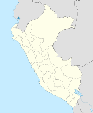
The hydroelectric power station Carpapata III (span. Central Hidroeléctrica Carpapata III ) is located on the Río Tarma in central Peru . The power plant is located in the Palca district in the Tarma province of the Junín administrative region . The plant went into operation in August 2016. The plant is operated by Generación Eléctrica Atocongo SA, a subsidiary of Unión Andina de Cementos SAA (UNACEM). The power plant serves u. a. the energy supply of the Condorcocha cement works located 30 km west-southwest.
Hydroelectric power plant
The hydropower plant is located at an altitude of 1980 m on the right bank of the Río Tarma. It is located in the Peruvian Central Cordillera , 24 km west-southwest of the city of San Ramón and 24 km northeast of the city of Tarma . The Carpapata III hydropower plant is part of a cascade of power plants on the Río Tarma - the Carpapata II and Huasahuasi II hydropower plants are upstream and the Yanango hydropower plant downstream .
The power plant has two horizontally-directed Francis turbines with an output of 6.35 MW each and a runner diameter of 910 mm, supplied by the Austrian company Gugler . The gross height of fall is 124.49 m, the net height of fall is 113.8 m, and the volume of water used is a total of 12.7 m³ / s.
Weir
About 2.4 km upstream there is a weir ( ⊙ ) with a sedimentation basin on the Río Tarma . 340 m above the weir, the Río Huasahuasi flows into the Río Tarma on the left. Another 480 m upstream on the Río Huasahuasi is the Huasahuasi II hydropower plant. The outflow from the Carpapata II hydropower plant is located directly on the weir. A 1.47 km long feed tunnel leads the turbine water from the Carpapata II power plant and the water diverted from the weir to a pressure pipe that runs along the Carpapata III power plant ends.
![]() Map with all coordinates: OSM | WikiMap
Map with all coordinates: OSM | WikiMap
Individual evidence
- ↑ a b c Central Hidroeléctrica Carpapata III (12.8 MW) (PDF, 1.0 MB) Osingergmin. Retrieved January 10, 2020.
- ↑ a b Carpapata III, Peru, 2014 . www.gugler.com. Retrieved January 10, 2020.
