
Weidenthal (Guteneck)
|
Weidenthal
Guteneck community (Schwandorf district)
Coordinates: 49 ° 28 ′ 5 ″ N , 12 ° 16 ′ 59 ″ E
|
|
|---|---|
| Height : | 492 m |
| Postal code : | 92543 |
| Area code : | 09433 |
 Weidenthal (2016)
|
|
Weidenthal is a district of the municipality Guteneck in Upper Palatinate district Schwandorf and member of the administrative community Nabburg .
geography
Weidenthal is located in the Oberpfalz-Mitte region, 7.5 kilometers east of the city of Nabburg . State road 2156 from Nabburg to Teunz leads north past the place.
history
The Weidenthaler family has been documented since 1147. Engelmar von Weidenthal sold an estate in Rottendorf to the Reichenbach monastery around 1200. In the period from 1300 Guteneck and Weidenthal are one unit. From this time on, the Murachers are court lords. In 1593 Hans Adam von Kreuth took over Guteneck and Weidenthal as a fief. "The von Kreuth family had acquired the dignity of imperial counts in 1694 and, since acquiring the Hofmark Gleiritsch in 1688, had the rulership title of Guteneck, Widenthal and Gleiritsch". The ownership history of Weidenthal and Guteneck is the same from the 13th to the 19th century.
Tax district
In 1811 there were a total of 58 tax districts in the Nabburg Regional Court. One of them was Weidenthal with Trichenricht and the forest Fürstenschlag and the stone wood. 34 houses with 123 inhabitants are given.
Church building
The Kingdom of Bavaria was divided into 15 districts in 1808. These districts were named after rivers based on the French model ( Naabkreis , Regenkreis , Unterdonaukreis , etc.). The districts were divided into district courts. The districts should in turn be divided into individual parish areas, which should also be based on the parish district. In 1811, the following places were assigned to the Pamsendorf chair: Pamsendorf, Trefnitz, Weidenthal, Gleiritsch, Steinach, Hebenhof, Stöcklhof, Krohermühle, Sägmühle. Since the localities were very far apart, new administrative units were created. In 1828 the following localities belonged to the Guteneck community: Guteneck, Weidenthal, Trichenricht, Oberkatzbach and Felsmühle.
photos

Weidenthal fire station, Trichenricht
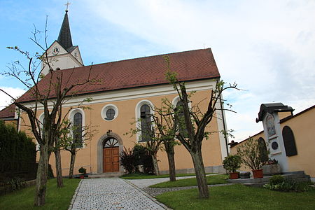
St. Michael Church

Sports grounds (2016)


Individual evidence
- ^ Ried, Thomas: Codex chornologico-diplomaticus, Ratisponensis, Regensburg 1816, Volume 1, p. 218
- ↑ Monumenta Boica, Vol. 27, 60, p. 43
- ^ Elisabeth Müller-Luckner: Historical Atlas of Bavaria, part of Altbayern, No. 50, Nabburg, Munich 1981, p. 174
- ↑ State Archives Amberg, Loyalty Documents Upper Palatinate, No. 21410
- ^ Elisabeth Müller-Luckner: Historical Atlas of Bavaria, part of Altbayern, No. 50, Nabburg, Munich 1981, p. 181
- ↑ Main State Archive Munich, Ministry of Finance, No. 10165
- ^ Emmering, Ernst, The Government of the Upper Palatinate, History of a Bavarian Central Authority, Contributions to the History and Regional Studies of the Upper Palatinate, Issue 20, Regensburg 1981, p. 12 ff.
- ^ Elisabeth Müller-Luckner: Historical Atlas of Bavaria, part of Old Bavaria, issue 50, Nabburg, Munich 1981, p. 407
- ↑ Elisabeth Müller-Luckner: Historical Atlas of Bavaria, part of Altbayern, No. 50, Nabburg, Munich 1981, p. 422
literature
- Elisabeth Müller-Luckner: Historical Atlas of Bavaria, part of Old Bavaria, Issue 50, Nabburg, Munich 1981, ISBN 3-7696-9915-7
- Karl-Otto Ambronn: Historical Atlas of Bavaria, Part of Old Bavaria, Series II, Book 3, Landsassen and Landsassengüter of the Principality of the Upper Palatinate in the 16th century, Munich 1982, ISBN 3-7696-9932-7
- Ernst Emmering: The government of the Upper Palatinate, history of a central Bavarian authority, contributions to the history and regional studies of the Upper Palatinate, issue 20, Regensburg 1981
- Thomas Ried: Codex chornologico-diplomaticus, Ratisponensis, Regensburg 1816
- Monumenta Boica, Munich 1763–1956
- Amberg State Archives, Fiefdoms Upper Palatinate, No. 21410
- Main State Archives Munich, Ministry of Finance, No. 10165
Web links

Rock mill | Guteneck | Häuslberg | Luigendorf | Maximilianshof | Mitteraich | Oberaich | Oberkatzbach | Pischdorf | Trefnitz | Trichenricht | Unteraich | Unterkatzbach | Weidenthal