White (river)
| White | ||
|
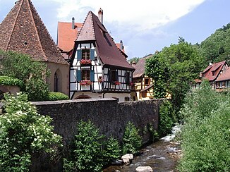
The Weiss in Kaysersberg |
||
| Data | ||
| Water code | FR : A21-0200 | |
| location |
France
|
|
| River system | Rhine | |
| Drain over | Fencing → Ill → Rhine → North Sea | |
| source | at the Collet du Linge 48 ° 5 ′ 25 ″ N , 7 ° 7 ′ 14 ″ E |
|
| Source height | approx. 850 m | |
| muzzle | at Sigolsheim in the fencing coordinates: 48 ° 7 '27 " N , 7 ° 20' 11" E 48 ° 7 '27 " N , 7 ° 20' 11" E |
|
| Mouth height | 188 m | |
| Height difference | approx. 662 m | |
| Bottom slope | approx. 27 ‰ | |
| length | 24.3 km | |
| Catchment area | 169.3 km² | |
| Drain at the mouth |
MQ |
2.99 m³ / s |
| Communities | Orbey , Lapoutroie , Kaysersberg , Kientzheim , Ammerschwihr , Sigolsheim | |
The Weiss (also Weissbach ) is a small river in the French department of Haut-Rhin that flows through the Kaysersberg valley. It is a good 24 km long left tributary of the Fecht .
geography
course
The Weiss rises at Collet du Linge at an altitude of around 850 m and flows into the Fecht from the left between Sigolsheim and Houssen , a tributary of the Ill , which flows into the Rhine near Strasbourg .
Tributaries
- Rotenbach ( left )
- Ruisseau du Lac Noir ( left ), 5.4 km
- Ruisseau du Lac Blanc ( left )
- Surcenord (German: Rodweilerbach) ( left ), 4.2 km
- Béchine (German: Beschbach) ( left ), 13.1 km
- Ure ( left ), 4.3 miles
- Limbach ( right )
- Brittelbach ( left ), 3.0 km
- Kleberbach ( right )
- Toggenbach ( left ), 3.7 km
- Walbach ( right ), 8.4 km
Places on the river
Individual evidence
- ↑ Weissbach near SANDRE (French)
- ↑ a b See: Débits caractéristiques de la Weiss
- ↑ a b Announcement concerning the change of French brook, mountain, forest, path, valley and field names, dated May 14, 1917. Frhr. von Tschammer , Strasbourg, May 14, 1917. Ministry for Alsace-Lorraine , Department of the Interior.
Web links
Commons : Weiss (river) - Collection of images, videos and audio files
- Débits caractéristiques de la Weiss (French; PDF; 12 kB)
