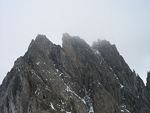
Wendenhorn
| Wendenhorn | ||
|---|---|---|
|
Wendenhorn from the west, taken from the yoke between the five-finger sticks and the Wendenhorn |
||
| height | 3023 m above sea level M. | |
| location | Border canton Uri / canton Bern , Switzerland | |
| Mountains | Uri Alps | |
| Dominance | 1.95 km → Titlis | |
| Notch height | 313 m ↓ Grassenpass | |
| Coordinates | 676 784 / 178569 | |
|
|
||
| Normal way | West ridge (rock II-III + glacier) | |
The Wendenhorn is a 3023 m high mountain in the Uri Alps . It is located south of the Titlis and north of the Sustenpassstrasse between the Fünffingerstöcken (southwest) and the Grassen (northeast). The border between the Swiss cantons of Uri and Bern runs over the summit .
The summit consists entirely of rock, which is framed by a small glacier , the Chli Sustlifirn. The Chli Sustlifirn should not be underestimated despite its small size and is relatively cleft .
The starting point for an ascent is the Sustenbrüggli (1907 m) on the Sustenpass road. The easiest climb leads either directly from Sustenbrüggli or via the Sustlihütte to the Stöss and from there to the Chli Sustlifirn. Via this glacier you reach the yoke between the Fünffingerstöcken (2994 m) and the Wendenhorn and from there via the west ridge (II-III) to the summit. The southeast ridge is also worthwhile (the first four pitches V, can be bypassed, then III). As a descent, you either cross the west ridge or abseil down the northeast face. The routes are only occasionally equipped with bolts.


