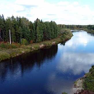
Wesljana (Kama)
|
Wesljana Весля́на |
||
| Data | ||
| Water code | RU : 10010100112111100001457 | |
| location | Komi Republic , Perm Region ( Russia ) | |
| River system | Volga | |
| Drain over | Kama → Volga → Caspian Sea | |
| source |
North Russian Ridge 61 ° 4 ′ 55 ″ N , 53 ° 25 ′ 33 ″ E |
|
| Source height | approx. 210 m | |
| muzzle |
Kama coordinates: 60 ° 19 ′ 26 ″ N , 54 ° 0 ′ 24 ″ E 60 ° 19 ′ 26 ″ N , 54 ° 0 ′ 24 ″ E |
|
| Mouth height | 145 m | |
| Height difference | approx. 65 m | |
| Bottom slope | approx. 0.24 ‰ | |
| length | 266 km | |
| Catchment area | 7490 km² | |
| Right tributaries | Chornaya | |
|
Wesljana (Весля́на) in the catchment area of the Kama |
||
The Wesljana ( Russian Весля́на ) is a left tributary of the Kama in the Russian region of Perm and in the Komi Republic .
The Wesljana is being built on the southern flank of the northern Russian ridge in the Komi Republic. It flows mainly in a southerly direction through the extreme north of the Perm region and finally meets the Kama, a left tributary of the Volga, which flows eastward in the upper reaches .
The Wesljana has a length of 266 km. It drains an area of 7490 km². The Wesljana was used at least earlier for rafting . The most important tributary of the Wesljana is the Tschornaja from the right.
Individual evidence
- ↑ a b c Article Wesljana in the Great Soviet Encyclopedia (BSE) , 3rd edition 1969–1978 (Russian)
- ↑ a b Wesljana in the State Water Directory of the Russian Federation (Russian)

