Whippany River
| Whippany River | ||
|
Map of the Passaic and Hackensack River basin |
||
| Data | ||
| Water code | US : 881771 | |
| location | New Jersey (USA) | |
| River system | Passaic River | |
| Drain over | Rockaway River → Passaic River → Atlantic Ocean | |
| source | in Morris County 40 ° 47'27 " N , 74 ° 35'7" W. |
|
| muzzle | in the Rockaway River coordinates: 40 ° 50 ′ 44 " N , 74 ° 20 ′ 30" W 40 ° 50 ′ 44 " N , 74 ° 20 ′ 30" W. |
|
| Mouth height |
49 m
|
|
| length | 32 km | |
|
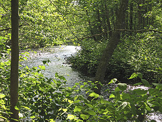
Whippany River in the Frelinghuysen Arboretum |
||
The Whippany River is an approximately 20 miles long tributary of the Rockaway River in northern New Jersey .
Its source is in Morris County , in Mendham Township west of Morristown . The direction of flow of the meandering river is east-north-east through Morristown and Whippany . It flows through the Troy Meadows and flows into the Hatfield Swamp in the Rockaway, just before it flows into the Passaic River .
The name is derived from the Whippanong tribe who used to inhabit the area. Whippanong means “place of the willows”, after the trees standing by the river.
Individual evidence
- ↑ USGS - GNIS - Whippany River
- ↑ Jerry Cheslow: If You're Thinking of Living In / Whippany, NJ; Where Houses Are In High Demand (English) , The New York Times . August 9, 1999. Retrieved April 5, 2009.
Web links
- NJ Skylands: Whippany River (English)
- US Geological Survey: NJ stream gaging stations (English)
- Whippany River Watershed Action Committee (English)

