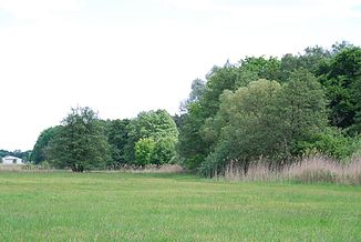
Wildgraben (Hahnwiesenbach)
|
Wild ditch Wilder Graben |
||
| Data | ||
| Water code | DE : 239828496 | |
| location | Germany | |
| River system | Rhine | |
| Drain over | Hahnwiesenbach → Apfelbach → Hegbach → Schwarzbach → Rhine → North Sea | |
| source | east of Erzhausen 49 ° 56 ′ 33 ″ N , 8 ° 39 ′ 23 ″ E |
|
| Source height | 122 m above sea level NN | |
| muzzle | southwest of Erzhausen from the right in the Hahnwiesenbach Coordinates: 49 ° 56 '48 " N , 8 ° 37' 7" E 49 ° 56 '48 " N , 8 ° 37' 7" E |
|
| Mouth height | 110 m above sea level NN | |
| Height difference | 12 m | |
| Bottom slope | 4.1 ‰ | |
| length | 2.9 km | |
The Wildgraben (also: Wilder Graben ) is a right, northern branch of the Hahnwiesenbach in the Darmstadt-Dieburg district .
course
The Wildgraben branches off at the border between the “Faulbruchwiese” forest district in Faulbruch near Erzhausen and the “Hahnfang” land district at 4.1 miles from the Hahnwiesenbach to the north. It runs in a westerly direction and crosses under the Main-Neckar railway line . Then it leads on the southern edge of Erzhausen through the Gewann “Schwarzwiese” and crosses under Wilhelm-Leuschner-Straße / K 167. The Erzhausen settlement “Ohlenberg” lies between the Wildgraben and the Hahnwiesenbach. About one kilometer further west in the “Höllwiese” valley, the Wildgraben flows into the Hahnwiesenbach again from the right, at 1.1 kilometers. This in turn flows into the Apfelbach and via the Hegbach and Schwarzbach near Ginsheim-Gustavsburg into the Ginsheimer Altrhein and the Rhine .
The wild moat is fed by several small streams and drainage ditches.
Individual evidence
- ↑ WFD kilometrage
