
Hegbach
|
Hegbach Heegbach |
||
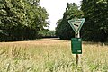
 Frankfurt-Egelsbach airfield with the Hegbach (front) and the center of the municipality of Egelsbach (back right; 2004) |
||
| Data | ||
| Water code | DE : 23982 | |
| location |
Messel hill country
|
|
| River system | Rhine | |
| Drain over | Schwarzbach → Rhine → North Sea | |
| origin |
Zsfls. Slip Stream / Fritz meadow ditch : south of Offenthal in the NSG Hegbachaue near Messel |
|
| Source height | approx. 178 m above sea level NHN source Rutschbach ;
|
|
| muzzle | to Nauheim (Groß-Gerau district) from the left into the Schwarzbach coordinates: 49 ° 56 '1 " N , 8 ° 27' 18" E 49 ° 56 '1 " N , 8 ° 27' 18" E |
|
| Mouth height | approx. 86 m above sea level NHN | |
| Height difference | approx. 92 m | |
| Bottom slope | approx. 3.2 ‰ | |
| length | 28.6 km | |
| Catchment area | 92.37 km² | |
| Discharge A Eo : 92.37 km² at the mouth |
MNQ MQ Mq |
60 l / s 176 l / s 1.9 l / (s km²) |
The Hegbach , also called Heegbach in historical sources , is a 28.6 km long, eastern and left tributary of the Schwarzbach . It flows in Darmstadt-Dieburg , in the Offenbach district , in the city of Darmstadt and Groß-Gerau district in Hesse . Its upper course bears the section name Rutschbach .
Names
The Hegbach probably got its name because of its border function - Hege means something like border . He went into the name of the natural environment subunit Hegbach apple Bach reason the Lower Main level one.
geography
course
The Hegbach is created by the confluence of the Fritzenwiesengraben, which flows from the north, and the Rutschbach, which flows from the east. The Fritzenwiesengraben rises near Offenthal . The source of the Rutschbach is located in the forest district on the long stone in the west of the Urberach district ; In some maps it is marked as Hegbach from the source and shares with this the same river code and is therefore the upper reaches of the Hegbach. In contrast to this, the name Rutschbach is retained in official land maps for the Hegbach until it crosses under the Bundesstraße 3 at the Bayerseich residential area in Egelsbach .
The Hegbach meanders in a westerly direction and initially flows through the 3 km long Hegbachaue nature reserve near Messel with the Ernst-Ludwig-Teich located 2.5 km east above the B 3 . The valleys of the Hegbach and Rutschbach brooks form the border between Darmstadt and the Darmstadt-Dieburg district in the south and the Offenbach district in the north until they pass under the federal motorway 5 . Between Egelsbach and Erzhausen , the Hegbach runs around the Frankfurt-Egelsbach airfield to the west in a creek bed artificially extended by 700 m. West of the A5, the stream flows south of Mörfelden through the urban area of Mörfelden-Walldorf . After crossing under the federal highway 67 near Nauheim, it feeds the Hegbachsee , which was cleared in the course of the highway construction.
The Hegbach flows 2.4 kilometers after the Hegbachsee between Nauheim and Groß-Gerau , after crossing under the state road 3482 (formerly B 42), from the left and east into the Schwarzbach , which later flows into the Rhine at Ginsheim-Gustavsburg through the Ginsheimer Altrhein .

Ernst-Ludwig-Teich (2008)
Hegbachaue (2016)
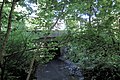
Hegbach near Mörfelden with the L3113 bridge

dried out Hegbach near Mörfelden with the L3113 bridge in summer 2019


Catchment area
The 92.37 km² catchment area of the Hegbach lies in the Messel hill country and in the Lower Main Plain . It is drained to the North Sea via the Schwarzbach and the Rhine .
It borders
- in the north and northeast to that of the Schwarzbach
- East to that of the Main tributary Rodau and to that of the Lache that drains into the Main via the Gersprenz
- and in the south to that of the Mühlbach , a tributary of the Schwarzbach.
The catchment area is largely forested.
Tributaries
Its tributaries, including its source streams, include, viewed downstream (according to the individual evidence mentioned in the table header):
| Surname | page | Length ( km ) |
Source | Muzzle | Estuarine location ( Location ) |
Mu stat. ( km ) |
EZG ( km² ) |
GKZ |
|---|---|---|---|---|---|---|---|---|
| height ( m above sea level ) | ||||||||
| Rutschbach (Hegbach Oberlauf) |
Left |
3 |
178 |
154 |
Bayerseich (o) |
25.65 |
4.81 |
23982 |
| Fritzenwiesengraben | right | 4th | 185 | 154 | Bayerseich (o) | 25.65 | 6.51 | 23982-12 |
|
Tränkbach (Tränkebach) |
right | 8.9 | 182.5 | 102 | Moerfelden (o) | 12.9 | 11.23 | 23982-4 |
| Kirchnerseckgraben | right | 9.2 | 157 | 99 | Moerfelden (o) | 11.45 | 23982-52 | |
|
Erzhausen stream (Gänswiesenbach, Ebertswinkelgraben) |
Left | 8th | 124 | 96.5 | Moerfelden (b) | 10.15 | 8.01 | 23982-6 |
| Septic tank | Left | 1.7 | 90.5 | 88 | Hegbachsee (o) | 3.05 | 23982-74 | |
| Apfelbach | Left | 13.7 | 113 | 87 | Hegbachsee (i) | 2.65 | 31.27 | 23982-8 |
| Silchergraben | Left | 3.4 | 90.5 | 86 | Hegbachsee (u) | 0.95 | 23982-92 | |
| Abbreviations (position) : o = above, u = below the point of the mouth; i = in the, b = at the point of discharge | ||||||||
history
As a companion of the medieval Landwehr, the Hegbach separated the Gerauer Mark from the Mark Langen . Later he formed the border between the Landgraviate of Hesse-Darmstadt and the Counties of Isenburg and Hanau . In the Middle Ages, there were so-called blows on the bridges over the brook , control points at the crossings from one to the other sovereign territory, from where the escort for carts on the forest trails at risk of attack was organized.
Grand Duke Ernst Ludwig had the Hegbach dammed; the Ernst Ludwig pond served as fishing water.
literature
- Roland Dotzert et al .: Stadtlexikon Darmstadt , Konrad Theiss Verlag GmbH, Stuttgart 2006, ISBN 3-8062-1930-3 and ISBN 978-3-8062-1930-2 , p. 358 f.
Individual evidence
- ↑ a b c d Map services of the Federal Agency for Nature Conservation ( information )
- ↑ a b c d e f Water map service of the Hessian Ministry for the Environment, Climate Protection, Agriculture and Consumer Protection ( information )
- ↑ Program of measures for surface waters
- ↑ Hegbachsee on nauheim.de
- ↑ Running water kilometrage of the Hegbach and estuary stations (Mü-Stat.) From the above inflow table according to the water map service of the Hessian Ministry for the Environment, Climate Protection, Agriculture and Consumer Protection ( information )
- ↑ For a better overview and sorting downstream, a hyphen has been inserted for each river in the water body code (GKZ) after the number “23982”, which stands for the Hegbach (with its upper course Rutschbach ).
Web links
- Retention cadastre river area Hegbach
- Map of the headwaters of the upper reaches of the Rutschbach . In: Landesgeschichtliches Informationssystem Hessen (LAGIS).
- The Heegbach on the large map of the surrounding area of Darmstadt in elevation. Scale 1: 20,000. Sheet 1: Langen. Giessen: Roth, 1895