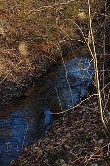
Apfelbach (Hegbach)
| Apfelbach | ||
|
Apfelbach near Steinrodsee in Weiterstadt |
||
| Data | ||
| Water code | DE : 239828 | |
| location |
Sub-level
|
|
| River system | Rhine | |
| Drain over | Hegbach → Schwarzbach → Rhine → North Sea | |
| origin | Tipping structure of the Mühlbach near Graefenhausen 49 ° 56 ′ 6 ″ N , 8 ° 37 ′ 41 ″ E |
|
| Source height | 113 m above sea level NHN | |
| muzzle | Before Nauheim from the east into the Hegbachsee and thus into the Hegbach Coordinates: 49 ° 56 ′ 56 ″ N , 8 ° 28 ′ 30 ″ E 49 ° 56 ′ 56 ″ N , 8 ° 28 ′ 30 ″ E |
|
| Mouth height | 86 m above sea level NHN | |
| Height difference | 27 m | |
| Bottom slope | 2 ‰ | |
| length | 13.8 km | |
| Catchment area | 31.27 km² | |
| Discharge A Eo : 31.27 km² at the mouth |
MNQ MQ Mq |
31.4 l / s 92.3 l / s 3 l / (s km²) |
The Apfelbach is an approximately 13.8 km long tributary to the left of the Hegbach and has contributed to the name of the natural subunit Hegbach-Apfelbach-Grund as part of the Lower Main Plain.
geography
course
The Apfelbach begins as an overflow at a tipping structure of the Mühlbach in the Gräfenhausen district between Sensfelder Hof and Ottilienmühle near the city limits of Darmstadt-Wixhausen . This first part of the stream bed was artificially created a long time ago to relieve the Mühlbach and leads the water away in a northerly direction. Because of the water overflow on the Mühlbach, the new body of water was initially called Abfallbach and it then became Apfelbach .
After a two-and-a-half kilometer run along the south and west edge of the forest known as Sensfelder Hardt and along the east bank of the Steinrodsee , the Apfelbach takes on the Hahnwiesenbach as the most important and longest tributary from the right and east . Then it leads the water, in contrast to the Mühlbach, which runs through many localities, far from any settlement through forest or forest edge areas in a westerly direction and finally flows into the Hegbachsee between Groß-Gerau and Nauheim .
Tributaries
The Apfelbach is fed by the following tributaries:
- Brühlwiesengraben
- Hahnwiesenbach
- Dohlgraben
Individual evidence
- ↑ retention cadastre
- ↑ Water map service of the Hessian Ministry for the Environment, Climate Protection, Agriculture and Consumer Protection ( information )
- ^ ASV Groß-Gerau: Apfelbach
