Recreation area Steinrod
The Steinrod recreation area is located in Graefenhausen , a district of the Hessian city of Weiterstadt .
The Steinrodsee
Emergence
The Steinrodsee was created in the 1930s during the industrial mining of sand and gravel for the construction of the Reichsautobahn Frankfurt am Main - Darmstadt (today Federal Motorway 5 ). After this use ended, the lake area was transformed into a leisure center and used as a swimming lake. After the exposure to bathers increased and the lake threatened to silt up, bathing was stopped. After the lake was elaborately desludged in 1992, bathing was no longer permitted and the area was designated as a quiet recreation area.
Technical specifications
The lake is 12 hectares and has a depth of 4 m.
Animals in the lake
There are numerous species of fish in the lake. These are: roach , bream , pike , pikeperch , carp , perch and eel . There are also ducks that swim their lanes on the lake.
The apple stream
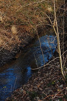
The artificially created apple stream branches off in the Weiterstadt-Graefenhausen district between Sensfelder Hof and Ottilienmühle near the border with Darmstadt-Wixhausen from the Mühlbach in a northerly direction. It then flows meandering through the Sensfelder Hardt forest, crosses federal motorway 5 , past Steinrodsee in a westward direction, to leave the city on the road to Mörfelden . From here it flows mostly through forest to the Hegbachsee near Groß-Gerau . The apple creek was often also called forest creek because it mostly leads through forest landscapes.
The polder
The polder was created in 1992 when the city of Weiterstadt had the Steinrodsee desludged. The visitor platform was created in April 1997. It allows an insight into the dry area of the polder. First a pond was created in the western part and a trench system in the middle area. The wetland can be flooded by means of an installed water pipe from the Gräfenhausen sprinkler association , which first happened in March 1995.
fauna and Flora
The rest of the polder is laid out as a sandy grassland with individual gravel beds and heaps of stones. These cairns serve Wiesel , sand lizard , slow worm , grass snake , even beetles and birds as a special habitat . In a relatively short time, diverse life has developed in the wet and dry areas. Starting with toads , frogs and dragonflies in the wetland, numerous species such as field tiger beetles , gloss beetles , grave wasps and parasitic wasps , butterflies , various species of horror , small mammals and rare bird species are represented in the dry area . Likewise, various plants have partly settled themselves or were planted. These include B. Mullein , evening primrose , willow , dogwood , field maple , elderberry , sea buckthorn , blackthorn , eucoat , adder head and various wild roses . In the wetland there are rushes , ledges , reeds , cattails and irises .
Kestrel , buzzard , red and black kite , tree falcon and now and then a hen harrier circle over the polder area looking for food. Various mammals such as ermine , bank vole and field vole live in the polder area.
Fishing hut & fishing club
The Fischerhütte, a restaurant with a large lake terrace, is located on the southern shore of Lake Steinrod. It was built in 1980 by the Angelsportverein Gräfenhausen eV and was initially managed by its own administration. The fishing club was founded on January 11th, 1964 and has since leased the Steinrodsee as fishing waters from the city of Weiterstadt. Today the club is called the fishing club Graefenhausen and has around 100 members.
campsite
Next to the Steinrodsee there is a campsite for short and long-term campers.
Fishing park
The fishing park is located next to the campsite, on an artificial lake. There is also a large beer garden as well as a playground and some animals in the outdoor enclosure. It was reopened on April 28, 2017 after being closed for a long time.
Individual evidence
- ^ Deuster, Thomas: Waters in and around Darmstadt, 2nd edition, 2008, ISBN 978-3-87820-130-4
- ↑ City of Darmstadt (PDF file; 3.52 MB), map of landscape protection areas, grid square B 6
Web links
Coordinates: 49 ° 56 ′ 32.5 ″ N , 8 ° 36 ′ 25.6 ″ E


