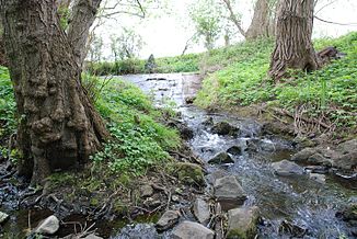
Brühlwiesengraben (Apfelbach)
| Brühlwiesengraben | ||
|
Brühlwiesengraben |
||
| Data | ||
| Water code | DE : 2398282 | |
| location |
Rhine-Main lowlands
|
|
| River system | Rhine | |
| Drain over | Apfelbach → Hegbach → Schwarzbach → Rhine → North Sea | |
| source | between Wixhausen and the research center to the east, 49 ° 56 ′ 0 ″ N , 8 ° 40 ′ 15 ″ E |
|
| Source height | 129 m above sea level NHN | |
| muzzle | Apfelbach / Abschlagbauwerk des Mühlbach near Graefenhausen Coordinates: 49 ° 56 ′ 7 ″ N , 8 ° 37 ′ 40 ″ E 49 ° 56 ′ 7 ″ N , 8 ° 37 ′ 40 ″ E |
|
| Mouth height | 113 m above sea level NHN | |
| Height difference | 16 m | |
| Bottom slope | 5.2 ‰ | |
| length | 3.1 km | |
| Catchment area | 2.24 km² | |
The Brühlwiesengraben is a right tributary of the Apfelbach and belongs to the natural subunit Hegbach-Apfelbach-Grund as part of the sub - Main level .
geography
course
The Brühlwiesengraben rises in the field between Darmstadt-Wixhausen and the GSI Helmholtz Center for Heavy Ion Research to the east . It flows on the northern edge of the built-up area of Wixhausen in a westerly direction and crosses under the Main-Neckar Railway . On the western edge of Wixhausen, the brook crosses under Wolfsgartenallee / K 167. West of Wolfsgartenallee, the Brühlwiesengraben joins the Apfelbach shortly after its origin at a tipping structure of the Mühlbach .
Catchment area
The 2.24 km² catchment area of the Brühlwiesengraben lies in the Hegbach-Apfelbach-Grund, a sub-unit of the Untermainebene natural area, and is drained to the North Sea via the Apfelbach, Hegbach , Schwarzbach and the Rhine .
It borders
- in the north to that of the Hahnwiesenbach , a tributary of the Apfelbach
- and in the south to that of the Schwarzbach tributary Mühlbach -
