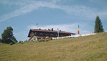
Winklmoos Alm
The Winklmoos-Alm is an extensive alpine pasture area in the Chiemgau Alps . It is located in the Upper Bavarian municipality of Reit im Winkl in the Traunstein district .
geography
The high plateau is located at an altitude of about 1170 m between the Dürrnbachhorn ( 1778 m ) and the Steinplatte ( 1870 m ). Together with the Austrian ski area on the Waidringer Steinplatte, it is a popular hiking area and an important ski center . In the field of Winklmoos- Alm there's only a few houses, huts and accommodation houses (including the Traunstein ski hut of the Alpine Club ). The ascent with your own car from Seegatterl on the B 305 to the Winklmoos-Alm over a steep mountain road (built in 1956) is only possible in summer. Since the beginning of the 2009/2010 winter season, the public bus service that was previously only possible in winter has been replaced by a gondola lift.
Others
The Winklmoos-Alm is also known as the home of multiple Olympic ski champion from 1976 Rosi Mittermaier .
Every year on August 15, a mountain mass with herb consecration takes place at the Chapel of the Assumption of Mary . The backdrop of this small church with the Loferer Steinberge in the background became the well-known symbol of the Winklmoos-Alm.
On April 27, 2018, the Winklmoos-Alm was awarded the International Dark-Sky Park certificate by the International Dark-Sky Association , making it the first star park in the Alps.
On the Winklmoosalm there is the Reichenhaller Haus (not to be confused with the Reichenhaller Haus of the German Alpine Club ), a property owned by the Bundeswehr , from where mountain hunters can ski .
Web links
- Winklmoos chairlift
- Winklmoosalm ski area
- Winklmoos Alm . In: Agricultural and cultural heritage database . Society for Agricultural History
Individual evidence
- ↑ "Star Park Winklmoos-Alm". In: ablebnis-sterne.de. May 3, 2018, accessed May 10, 2018 .
- ↑ "Winklmoosalm (Germany)". In: darksky.org. Retrieved May 10, 2018 .
- ↑ BwDLZ Bad Reichenhall. Retrieved August 13, 2020 .
- ↑ Skiing leisure time for soldiers and their families. March 6, 2018, accessed August 13, 2020 .
Coordinates: 47 ° 39 ′ 25 ″ N , 12 ° 35 ′ 3 ″ E


