Wirmsthal
|
Wirmsthal
Market Euerdorf
|
||
|---|---|---|
| Coordinates: 50 ° 9 ′ 0 ″ N , 10 ° 3 ′ 50 ″ E | ||
| Incorporation : | May 1, 1978 | |
| Postal code : | 97717 | |
| Area code : | 09704 | |
|
Location of Wirmsthal in Bavaria |
||
Wirmsthal is a district of the Lower Franconian market Euerdorf in the Bavarian district of Bad Kissingen . Wirmsthal is the northernmost wine village in the Franconian wine region and one of several wine-growing places in the region.
Geographical location
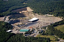
Wirmsthal is located east of Euerdorf on the KG 7 district road . To the west the KG 7 joins the KG 4 , which leads to Ramsthal on the one hand and joins the St 2290 on the other . East leaves the place a community connecting road near the landfill Wirmsthal in the KG 46 passes, in the national road 286 leads.
history
Wirmsthal emerged as the settlement of a Widem estate, which was the benefice of a church or a monastery. From this, starting with “Widermestal” and “Widmerstal”, the current name of the place developed. It is assumed that the farm of the Echternach winery manager was established in 715.
The place, which belongs to the original parish, had several owners over time, such as Fulda , Würzburg and the Lords of Trimberg and Henneberg , until it finally went to the Würzburg Monastery. The first known mention of a Wirmsthal church comes from the year 1614; however, its time of origin is unknown. Around that time, local cemetery was established. Today's St. John the Baptist Church in Wirmsthal was built in 1823.
Up until the First World War, Wirmsthal was known not only for wine growing but also for its fruit growing. However, this changed with the increased import of tropical fruits.
In 1950, the KG 7 was a connecting road between Wirmsthal and Euerdorf.
On May 1, 1978 Wirmsthal became a district of Euerdorf as part of the municipal reform .
Individual evidence
- ^ Federal Statistical Office (ed.): Historical municipality directory for the Federal Republic of Germany. Name, border and key number changes in municipalities, counties and administrative districts from May 27, 1970 to December 31, 1982 . W. Kohlhammer GmbH, Stuttgart and Mainz 1983, ISBN 3-17-003263-1 , p. 739 .


