Wissthur
|
Wissthur Wiss Thur |
||
|
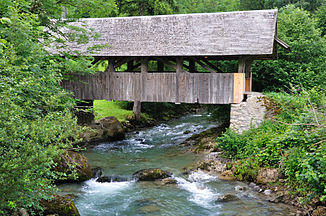
The Wissthur shortly before the confluence with the Thur |
||
| Data | ||
| Water code | CH : 2281 | |
| location | St. Gallen ; Switzerland | |
| River system | Rhine | |
| Drain over | Thur → Rhine → North Sea | |
| source | on the southern flank of the spear 47 ° 10 ′ 57 ″ N , 9 ° 7 ′ 28 ″ E |
|
| Source height | approx. 1740 m | |
| muzzle | at Stein SG in the Thur coordinates: 47 ° 12 '9 " N , 9 ° 13' 12" E ; CH1903: 734 959 / 229491 47 ° 12 '9 " N , 9 ° 13' 12" O |
|
| Mouth height | 826 m | |
| Height difference | approx. 914 m | |
| Bottom slope | approx. 11% | |
| length | 8.5 km | |
| Catchment area | 17.6 km² | |
| Discharge at the estuary A Eo : 17.6 km² |
MQ Mq |
1.01 m³ / s 57.4 l / (s km²) |
| Communities | Nesslau | |
The Wissthur is a left tributary of the Thur in the Swiss canton of St. Gallen . It rises on the southern flank of the Speer , which is 1956 m above sea level. M. Europe's highest Nagelfluh mountain .
It flows from the Speer in an east-northeast direction through the wide Hinterlaad valley and then through the Wandbleiktobel. The Wissthur empties after 8.5 km at 826 m above sea level. M. at the lowest point of the former municipality of Stein in the Thur.
Individual evidence
- ↑ a b c d Geoserver of the Swiss Federal Administration ( information )
- ↑ Modeled mean annual discharge. In: Topographical catchment areas of Swiss waters: area outlets. Retrieved August 14, 2016 .
