Volia veža
| Volia veža | ||
|---|---|---|
|
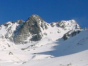
View from the south of the Volia veža and Žabia veža |
||
| height | 2373 m | |
| location | Poland , Slovakia | |
| Mountains | High Tatras | |
| Coordinates | 49 ° 10 '47 " N , 20 ° 4' 27" E | |
|
|
||
| Type | Rock peaks | |
| rock | granite | |
| First ascent | September 11, 1905 by Simon Häberlein and Kathrine Bröske | |
The Volia veža (Polish Wołowa Turnia , German: Ochsenrückenturm) is a mountain in the High Tatras with a height of 2373 m npm on the Polish - Slovak border. It is the eighth highest mountain in Poland.
Location and surroundings
Below the summit the valleys are Fish Lake Valley with the lake Czarny Staw pod Rysami in the north (Poland) and Mengsdorfer valley in the south (Slovakia).
The ox back tower is located in the main ridge of the Tatras , in the midst of the ox's back ( wołowy Grzbiet ). Neighboring peaks are Froschseeturm ( Żabia Turnia Mięguszowiecka ) from it by the Eastern Ochs back-lip ( Żabia Przełęcz Mięguszowiecka is separated), and from it by the Big Ochs back-lip ( Wielka Wołowa Szczerbina separate) Hinzenseeturm ( Hińczowa Turnia / Hincová veža ).
etymology
The name Volia veža can be translated as an ox tower . The name comes from the fact that there are in the Wołowy Grzbiet massif . The German name Ochsenrückenturm also refers to the Wołowy Grzbiet massif, in German: ox back.
Ascent
The first ascent took place in
- Summer: Katherine Bröske and Simon Häberlein , September 11, 1905
- Winter: Alfréd Grósz , April 5, 1913
The via ferrata in the Stanisławski chimney in the north face was made accessible on September 3, 1939 by Wiesław Stanisławski and Zbigniewem Gieysztor .
tourism
The Volia veža is not on any marked hiking trail. However, it is accessible to climbers with a permit from the administration of one of the national parks . The shelters Schronisko PTTK nad Morskim Okiem and Schronisko PTTK w Dolinie Roztoki are suitable starting points for an ascent . Its north face above the mountain lake Czarny Staw pod Rysami is about 400 meters high. On the other hand, the slope falls relatively flat to the south.
Web links
supporting documents
- Zofia Radwańska-Paryska, Witold Henryk Paryski, Wielka encyklopedia tatrzańska, Poronin, Wyd. Górskie, 2004, ISBN 83-7104-009-1 .
- Tatry Wysokie słowackie i polskie. Mapa turystyczna 1: 25.000, Warszawa, 2005/06, Polkart ISBN 83-87873-26-8 .

