Wolkensteinerberg
| Wolkensteinerberg
(Selva)
|
||
|---|---|---|
|
Upper Rhine with Hemishofen (middle) and Wolkensteinerberg (right) |
||
| height | 608 m above sea level M. | |
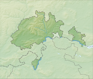
| location | near Hemishofen and Stein am Rhein ; Canton of Schaffhausen ( Switzerland ) | |
| Mountains | Schiener Berg | |
| Dominance | 1.8 km → Kressenberg | |
| Notch height | 69 m ↓ northeast. Steinerwäg | |
| Coordinates | 705 360 / 281582 | |
|
|
||
The Wolkensteinerberg , colloquially known as Wolkenstein , is 608 m above sea level. M. high elevation in the municipal areas of Hemishofen and Stein am Rhein in the upper, eastern part of the Swiss canton of Schaffhausen . It is a western branch of the Schiener Berg ridge located in the border area with Germany , which - in its German part - a maximum of 715.6 m above sea level. NHN is high.
geography
location
The Wolkensteinerberg rises east of Hemishofen and north to northwest of Stein am Rhein , both of which are located on the Upper Rhine . The landscape drops in the southeast to Öhningen , and in the northeast it leads over the Mount of Olives ( 625 m ) to rails , both of which are located across the border in Germany.
Natural allocation
The Wolkensteinerberg belongs to the natural spatial main unit group pre-alpine hill and moorland (No. 03), in the main unit Northern Lake Constance and Hegau basin (030/031) and in the subunit Südwesthegauer Bergland (030 / 031.1) to the natural area Schienerberg (with Höri -Uferland) (030 / 031.13).
Castles
On a rocky spur of the Wolkensteinerberg, the Wolkenstein Castle was built in the 12th century , of which only the castle stables remain. Hohenklingen Castle is 2.1 km southeast of it .
Individual evidence
- ↑ a b Geoserver of the Swiss Federal Administration ( information )
Web links
- Wolkensteinerberg , on hikr.org

