Yule Bay
| Yule Bay | ||
|---|---|---|
| Waters | Somow lake | |
| Land mass | Victoria Land , East Antarctica | |
| Geographical location | 70 ° 44 ′ S , 166 ° 40 ′ E | |
|
|
||
| width | 11 km | |
| Islands | Sentry Rocks , Unger Island | |
| Tributaries | Chapman Glacier , Fortenberry Glacier , O'Hara Glacier | |
|
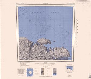
1968 Pennell Coast map , Yule Bay in the middle of the southern half of the map |
||
The Yule Bay is an 11 km wide bay on the Pennell Coast of northern Victoria Land . It is located about 29 km east-southeast of Cape North between Cape Hooker and Cape Dayman . The inner, d. H. western part of the bay is bounded by Bates Point and Ackroyd Point .
It was discovered in 1841 by the British polar explorer James Clark Ross during his Antarctic expedition (1839–1843). Ross named the bay after Henry Braddik Yule (1810-1899), Second Master on the expedition ship HMS Erebus .
Web links
- Yule Bay in the Geographic Names Information System of the United States Geological Survey (English)
- Yule Bay on geographic.org (English)

