Yungaburra
| Yungaburra | |||||||||
|---|---|---|---|---|---|---|---|---|---|
|
|||||||||
|
|||||||||
|
|||||||||
|
|||||||||
|
|
|||||||||
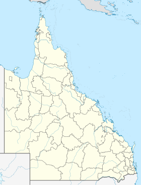
Yungaburra is a town in the middle of the Atherton Tableland in Queensland , Australia with 1043 residents. It is about eight miles east of Atherton and an hour's drive from Cairns on the Gillies Highway . The place lies in a clearing of the surrounding rainforest. The area was shaped by volcanic activity. The volcanic mountains, craters, the tropical rainforest with its many waterfalls and the nearby Crater Lakes and Curtain Fig National Park attract numerous tourists every year.
history
The place was founded in 1890 as a resting place for travelers towards the Inland Outback and was initially called "Allumbah Pocket". "Allumbah" was initially just a hut village. A sawmill was built in 1910. Tropical wood, mainly cedar, was felled in the area and processed here. The place has preserved many of the old buildings to this day. Yungaburra has the largest number of registered historic buildings in Queensland.
geography
The Atherton Tableland is an ideal recreational area for any tourist. There are many natural and cultural attractions. These include waterfalls, volcanic craters, historical mines, cities, museums, exotic bird and animal watching in the tropical rainforest. This results in many activities such as canoeing, swimming, sailing, fishing and the very adventurous " bush walking " ( German : hiking off the beaten track) and visiting national parks . Particularly noteworthy are the volcanic craters Lake Eacham and Lake Barrine in the vicinity of Yungaburra . Lake Eacham, with its nearby campsite, hiking trails and refreshing water, is particularly suitable for a longer visit.
climate
Yungaburra is in the tropics and therefore only experiences two seasons. The low humidity in summer is called natural air conditioning. In winter there is a cool but mild climate.
|
Average Monthly Temperatures and Precipitation for KAIRI RESEARCH STATION - Altitude: 717 m from 1952 to 2011
Source:
|
|||||||||||||||||||||||||||||||||||||||||||||||||||||||||||||||||||||||||||||||||||||||||||||||||||||||||||||||||||||||||||||||||||||||
Flora and fauna
The rainforest and the always warm temperatures with a lot of rain make the region around Yungaburra stand out as a green oasis from the otherwise prevailing Australian drought. The flora and fauna can be described as rich. In terms of animals, platypuses , tree kangaroos and turtles should be mentioned.
traffic
The Gillies Highway leads through Yungaburra to Atherton and to Gordonvale on the coast.
economy
The land around Yungaburra is used for growing many crops. Potatoes, sugar cane, mangoes, corn, avocados, peanuts. The Atherton Tablelands are one of the most productive agricultural areas in Australia. The region lives from agriculture. At any time of the year something is being harvested and harvest workers are sought. North of Yungaburra, the Barron River is dammed to Lake Tinaroo and is used to irrigate the surrounding agriculture.
Web links
Individual evidence
- ↑ a b Australian Bureau of Statistics : Yungaburra ( English ) In: 2016 Census QuickStats . June 27, 2017. Retrieved April 15, 2020.
- ↑ Climate statistics for Australian locations (KAIRI RESEARCH STATION) ( English ) Australian Government - Bureau of Meteorology . Retrieved June 6, 2009.
