Zeller Blauen
| Zeller Blauen | ||
|---|---|---|
|
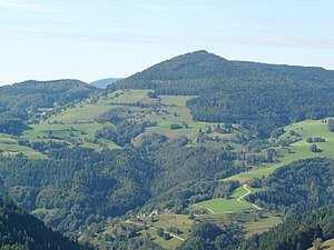
Zeller Blauen from the southwest |
||
| height | 1077 m above sea level NHN | |
| location | Baden-Wuerttemberg , Germany | |
| Mountains | Black Forest | |
| Coordinates | 47 ° 44 '3 " N , 7 ° 51' 6" E | |
|
|
||
The Zeller Blauen (now rarer: Hochblauen ) is 1077 m above sea level. NHN high mountain in the southern Black Forest . It belongs to Zell im Wiesental in the Baden-Württemberg district of Lörrach .
With its steep slope to the south, west and east, the mountain dominates the meadow valley north of the city of Zell and towers over it by more than 600 meters. To the north, from the wooded summit area of the Zeller Blauen, between the Kleiner Wiesental in the west and the Wiesental in the east, a ridge continues up to the Belchen , ten kilometers away .
Remains of entrenchments can be found along the southern flank of the Zeller Blauen . On the western slope, about 700 to 800 meters above sea level, the hamlets of Blauen and Oberblauen lie within the boundaries of the Adelsberg district of Zell .
In a Black Forest map of the St. Blasien monastery from 1788, the mountain is referred to as "on the high blue". In the topographical atlas of the Grand Duchy of Baden , it is called "Hochblauen" in 1846. This designation is also common for the Blauen mountain near Badenweiler, which is twelve kilometers west-northwest .
Web links
Individual evidence
- ↑ Map services of the Federal Agency for Nature Conservation ( information )
- ↑ cf. BFN map service , accessed on July 19, 2013
- ^ Mappa geographica ad Historiam Nigrae Silvae Martini Gerberti SRIP Monasterii & Congreg. S. Blasii abbatis / del. P. Bonifac. Grüninger ...; engraved by Johann Bap. Haas. Sankt Blasien, 1788 ( online )
- ↑ Todtnau. Sheet XI.2 in: Topographical Atlas over the Grand Duchy of Baden. Karlsruhe 1846 ( online )

