Ziemenbach
| Ziemenbach | ||
|
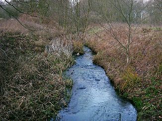
The Ziemenbach between Hohenzieritz and Prillwitz |
||
| Data | ||
| Water code | DE : 9664114 (upper course), 9664 (lower course as part of the Tollense) | |
| location | District of Mecklenburg Lake District | |
| River system | Peene | |
| Drain over | Tollense → Peene → Peenestrom → Baltic Sea | |
| River basin district | Warnow / Peene | |
| source |
Krebssee near Weisdin 53 ° 25 ′ 39 ″ N , 13 ° 2 ′ 47 ″ E |
|
| Source height | approx. 25 m | |
| muzzle | west of Prillwitz in the Lieps coordinates: 53 ° 27 '25 " N , 13 ° 8' 13" E 53 ° 27 '25 " N , 13 ° 8' 13" E |
|
| Mouth height | approx. 15 m | |
| Height difference | approx. 10 m | |
| Bottom slope | approx. 2.4 ‰ | |
| length | 4.2 km | |
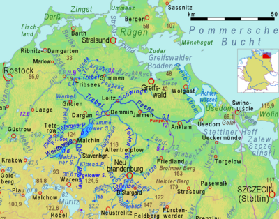
The Ziemenbach is a four kilometer long river in the Mecklenburg Lake District and flows into the Lieps , a small fore lake of the Tollensesees .
Source stream of the Tollense
The Ziemenbach forms part of the hydrological upper reaches of the Tollense . This rises 800 m northeast of the 70.5 m above sea level. NHN located Mürzsee east of Blumenholz , in its source base approximately at the level of the lake. This is followed in a south and west close to each other by three more lakes, a Mittelsee (69.7 m), a Langer See (69.3 m) and the one at the angle between the B 96 ( E 251 ) and the Berlin – Neustrelitz – Rostock railway line located Krebssee (68.8 m). The stream leaves this to the north and loses 45 meters in altitude on the five kilometers to the sandmill, about 25 m above sea level. NHN, from which he is called Ziemenbach. From the sand mill it is another 4.2 kilometers to the Lieps.
Creek in the valley
At the sand mill, the spring water of the Tollense receives an inlet (GKZ 9664114) from the western part of the valley, 5.3 river kilometers above this confluence and 55 meters above sea level from the union of a 60.4 m above sea level. NHN located source and a 450 m long source stream below the Brustorf forestry in the municipality of Klein Many . The labeling as Ziemenbach is wrong. As far as the sand mill it flows through a twenty to thirty meter deep, winding and mostly narrow valley.
As the upper reaches of the Tollense, the lower reaches of the Ziemenbach flows through a straight valley with a wide valley floor, designated as the Ziemenbachtal nature reserve . The last kilometer to the confluence west of Hohenzieritz- Prillwitz flows through silted areas in the common basin of Lieps and Tollensesee.
Mills
In the past, water mills at Sandmühle and Hohenzieritz were operated with the Ziemenbach . The operation of these mills ceased in the 1950s.
Web links
Individual evidence
- ↑ a b GAIA-MV, Topics: Water a. topographical background
- ↑ Direct information from LUNG, inquired about currently implausible height information in the DTK

