Giant Springs
About
Before Lewis and Clark first described the main feature of Giant Springs State Park the spring, during their exploration of the Louisiana Purchase in 1805, the area near the springs was used as wintering grounds for the Blackfeet tribe. Since the springs remained at a constant temperature, the water never froze and drinking water was much more readily available and the tribe could avoid having to break through the frozen Missouri River. Once the city of Great Falls, Montana was established in 1884, the park developed and served as a leisure park for city dwellers until the mid-1970's when it was established as a Montana State Park. [1]
Today the park is one of the most visited state parks in Montana with approximately 300,000 people visiting each year to take a gander at the park's namesake-the springs. While the springs are a wonder to see-there are many other things to do at Giant Springs State Park. In addition to the "park" area which includes the Springs, the Ranger Station, the Fish Hatchery, a family fishing pond, a few trail loops and 3 Reservation Areas (Heritage, Springs and Central) there are over 4,500 acres of front and backcountry to explore.
The park also features another amazing sight of Montana-the town’s name sake “The Great Falls.” The Great Falls of the Missouri are only 1 of 4 waterfalls located within the Park some of which feature hydroelectric dams owned by Northwestern Energy. All of the waterfalls and most of the dams are viewable by road and overlooks throughout the Park (Overlook Amenities: vault restrooms, info panels).
Hydrology of the Springs
The central feature of Giant Springs State Park is spring, a large first magnitude spring located near Great Falls, Montana. Its water has a constant temperature of 54 °F (12 °C). The crystal clear water originates from snow melt in the Little Belt Mountains, 60 miles (97 km) away. According to chlorofluorocarbon dating, the water takes 26 years to travel underground from the Little Belt Mountains to where the Madison Aquifer bubbles up to form the springs. The Madison aquifer is a vast aquifer underlying 5 U.S. States and 3 Canadian Provinces.[2] The conduit between the mountains and the spring is the geological stratum found in parts of the northwest United States called Madison Limestone. Although some of the underground water from the Little Belt Mountains escapes to form Giant Springs, some stays underground and continues flowing, joining sources from losing streams in the Black Hills, Big Horn Mountains and other areas. The aquifer eventually surfaces in Canada.

Giant Springs has an average discharge of 242 cubic feet (6.9 m3) of water per second.[3]
Spring Use
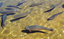
Today, much of the water from the springs flows into the Missouri River either directly or via the 200-foot (61 m)-long Roe River, once holding the record as being one of the two shortest rivers in the world according to Guinness Book of World Records. Some of the spring water (less then .01% of the annual flow) is bottled annually for human consumption. Some of the discharge is also used to run the trout hatchery, called the Giant Springs Trout Hatchery.[4]

Things to Do
Recreation opportunities are endless within the park, you can:fish, hunt, hike, bike, bird watch or just have a relaxing picnic under the trees. The fishing is phenomenal from Roe Island; you have the springs bubbling out into the Missouri on one side and the springs running down the Roe River on the other side. If river fishing is not for you, there is the Family Fishing Pond with 5 docks for easy access and great fishing. If you are a hunter, there are acres of land that you can access, thanks to a conservation easement from Northwestern Energy. Hunting opportunities include waterfowl, upland game birds & deer. Just like some peace and quiet? Take a stroll down one of the miles of paved or dirt trails that provide beautiful views of the Missouri around every corner.
See also
References
- ^ http://fwp.mt.gov/mtoutdoors/HTML/articles/2005/GiantSprings.htm
- ^ "Madison Aquifer". United States Geological Survey. Retrieved May 5, 2012.
- ^ Cite error: The named reference
MTSPwas invoked but never defined (see the help page). - ^ "Giant Springs Trout Hatchery". Montana Fish, Wildlife & Parks. Retrieved May 5, 2012.
