Custer National Forest
|
Custer National Forest
|
|
| location | Montana - South Dakota , USA |
| surface | 5,173.03 km² |
| Geographical location | 45 ° 19 ′ N , 109 ° 48 ′ W |
| Setup date | March 2, 1907 |
| administration | US Forest Service |
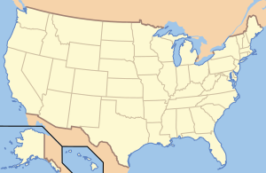
The Custer National Forest is a National Forest of the United States in the southern part of the US state of Montana and in northwestern South Dakota . It has a total area of 5,173.03 km² and consists of ten individual sections. While the western parts of the Custer National Forest belong to the Greater Yellowstone Ecosystem , those further east are a combination of "forest islands" and grassland . The forest also covers a third of the Absaroka-Beartooth Wilderness . South of Red Lodge , the Beartooth Highway (US Highway 212) leads through the wooded area to Yellowstone National Park .
history
Native American burial sites, pictograms, and petroglyphs are located within the national forest . For the Plains Indians , the forest offered safe shelter and a permanent source of food. The members of the Lewis and Clark Expedition are generally considered to be the first white Americans in the region.
The Custer National Forest was first established as Otter National Forest on March 2, 1907 by the US Forest Service . On July 1, 1908 , the name was changed to Custer. On January 13, 1920 , the Sioux National Forest was added from South Dakota, which now forms the Sioux Ranger District. The Sioux was previously composed of the Cave Hills , Ekalaka , Long Pine , Short Pine and Slim Buttes National Forests on July 1, 1908 . On February 17, 1932 , a portion of the Beartooth National Forest was included, which now forms the Beartooth District.
Natural space
The eastern areas are dominated by yellow pines and grassland, which is often leased to local ranchers. The relatively rare Merlin Falcon is more common here than anywhere else in the United States. Furthermore, mule deer , pronghorn and elk are observed. Most of the eastern sections attach great importance to land conservation and work closely with loggers and ranchers together.
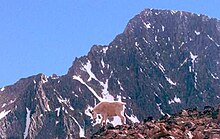
Pine , spruce and fir trees grow in the western part , as it is more mountainous and rainy. Here live Grizzlies , American black bears , bighorn sheep , mountain goats and buffalo , which, however, are not as numerous as in southern Yellowstone National Park. In the more mountainous regions deep in the wilderness areas, alpine conditions prevail. On the border of the Gallatin National Forest is Granite Peak, the highest mountain in Montana, as well as Grasshopper Glacier , where millions of migratory locusts died about three hundred years ago and were preserved in the ice.
Forest management
Currently, the Custer National Forest is divided into three forest districts:
- Beartooth Ranger District ( Red Lodge , Montana)
- Ashland Ranger District ( Ashland , Montana)
- Sioux Ranger District ( Camp Crook , South Dakota)
In the past, four United States National Grasslands were managed by the national forest: the Grand River , Cedar River , Little Missouri and Sheyenne National Grassland . These are now run as Dakota Prairie Grasslands with headquarters in Bismarck (North Dakota) .
The land area of the Custer National Forest covers portions of Powder River , Carbon , Stillwater , Rosebud , Carter , Sweet Grass , Harding (the only county in South Dakota), and Park Counties . South Dakota is only 6.2 percent of the total area.
tourism
There are over thirty campsites accessible by car as well as numerous picnic areas in the forest area. There are more than 2,400 kilometers of hiking trails available, most of which can be found in the western district. Although there are few rivers and lakes, there are some fishing opportunities. Most of the campsites and hiking trails are in the region south and southwest of Billings , which is also where the National Forests headquarters are located.
Web links
Individual evidence
- ↑ Sioux Ranger District ( English ) In: Custer National Forest . US Forest Service. August 23, 2008. Retrieved June 3, 2011.
- ↑ Beartooth Ranger District ( English ) In: Custer National Forest . US Forest Service. August 24, 2008. Retrieved June 3, 2011.
- ^ Davis, Richard C .: National Forests of the United States ( English , PDF; 368 kB) The Forest History Society. S. September 15, 29, 2005. Archived from the original on February 12, 2013. Info: The archive link was inserted automatically and has not yet been checked. Please check the original and archive link according to the instructions and then remove this notice. Retrieved June 3, 2011.
- ↑ USFS Ranger Districts by State (PDF; 207 kB)

