
Newport State Park: Difference between revisions
m Task 18 (cosmetic): eval 3 templates: hyphenate params (2×); del |url-status= (2×); |
|||
| Line 78: | Line 78: | ||
==External links== |
==External links== |
||
*[https://friendsofnewport.org Newport Wilderness Society] (Friends Group of Newport State Park) |
|||
*[http://dnr.wi.gov/topic/parks/name/newport/ Newport State Park website] |
*[http://dnr.wi.gov/topic/parks/name/newport/ Newport State Park website] |
||
Revision as of 04:22, 29 January 2021
| Newport State Park | |
|---|---|
IUCN category V (protected landscape/seascape) | |
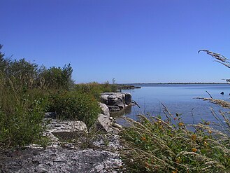
 Outcroppings at Newport State Park approximately 10 feet (3 m; 3 yd) from Lake Michigan. | |
  | |
| Location | Door, Wisconsin, United States |
| Coordinates | 45°14′6″N 86°59′39″W / 45.23500°N 86.99417°W |
| Area | 2,373 acres (9.60 km2) |
| Established | 1964 |
| Governing body | Wisconsin Department of Natural Resources |
Newport State Park is a 2,373-acre (960 ha) Wisconsin state park at the tip of Door Peninsula near Ellison Bay, Wisconsin. Protecting 11 miles (18 km) of shoreline on Lake Michigan, Newport is Wisconsin's only wilderness-designated state park. In 2017, the International Dark-Sky Association named Newport a Dark-sky preserve.[1] The park is open year-round[2] and can be accessed via Wisconsin state highway 42.
Air pollution monitor

The only public air pollution monitor in the county is located in Newport State Park.[3] Most air pollution reaching the station comes from outside the county. This map shows how air travels to the monitoring station. Because the station is near the shore, only the red lines (which show the lower air currents) meaningfully depict the path of ozone to the monitor. As shown on the map, these lower air currents carry polluted air from major urban areas. Farther inland, however, the air from higher up mixes more, so all color lines are significant when tracing the path of air pollution further inland, and these higher air currents (shown in green and blue) blow in from cleaner, mostly rural areas.[4]
Gallery
-
 Near the shore
 -
 Duck Bay along Newport Trail with reed canary grass (Phalaris arundinacea) and orange jewelweed (Impatiens capensis) flowers
 -
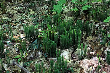 Common club-moss, Spinulum annotinum (synonym: Lycopodium annotinum), August
 -
 Sign
Sign -
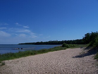
 Looking north at the beach with kayakers
 -
 Looking south at the beach
 -
 Campsite #3
 -
 Ranger station
 -
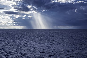 Rainfall over Lake Michigan, seen from Newport State Park in July


See also
References
- ^ Lee Bergquist. "Newport State Park designated as Wisconsin's first 'dark sky' park/". Milwaukee Journal Sentinel, June 7, 2017.
- ^ "Newport State Park - Wisconsin DNR". dnr.wi.gov. Retrieved 2018-07-06.
- ^ Photo of the monitoring station on page 128 of WI DNR. "Air Monitoring Network Plan 2016 June 2015" (PDF). EPA. Retrieved 2019-02-06.
- ^ US EPA. "Wisconsin: Northern Milwaukee/Ozaukee Shoreline Area, Sheboygan County Area, Manitowoc County Area, Door County Area Final Area Designations for the 2015 Ozone National Ambient Air Quality Standards Technical Support Document (TSD)" (PDF). Green Book. Retrieved 2019-02-07.
Bibliography
External links
- Newport Wilderness Society (Friends Group of Newport State Park)
- Newport State Park website
| International | |
|---|---|
| National | |
This article about a location in Door County, Wisconsin is a stub. You can help Wikipedia by expanding it. |