Potamos tou Kampou: Difference between revisions
Content deleted Content added
New district established |
JJMC89 bot (talk | contribs) Migrate {{Infobox settlement}} coordinates parameters to {{Coord}}, see Wikipedia:Coordinates in infoboxes |
||
| Line 22: | Line 22: | ||
| pushpin_map_alt = |
| pushpin_map_alt = |
||
| pushpin_map_caption = |
| pushpin_map_caption = |
||
| coordinates = {{coord|35|08|39|N|32|48|28|E|region:CY|display=inline,title}} |
|||
| latd = 35 |latm = 08 |lats = 39 |latNS = N |
|||
| longd = 32 |longm = 48 |longs = 28 |longEW = E |
|||
| coor_pinpoint = |
| coor_pinpoint = |
||
| coordinates_type = |
|||
| coordinates_display = inline,title |
|||
| coordinates_footnotes = |
| coordinates_footnotes = |
||
| coordinates_region = CY |
|||
| subdivision_type = Country |
| subdivision_type = Country |
||
| subdivision_name = {{flag|Cyprus}} |
| subdivision_name = {{flag|Cyprus}} |
||
Revision as of 08:57, 29 March 2017
Potamos tou Kampou
| |
|---|---|
| Coordinates: 35°08′39″N 32°48′28″E / 35.14417°N 32.80778°E | |
| Country | |
| • District | Nicosia District |
| Country (controlled by) | |
| • District | Lefke District |
| Population (2011)[1] | |
| • Total | 669 |
| Time zone | UTC+2 (EET) |
| • Summer (DST) | UTC+3 (EEST) |
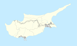
Potamos tou Kampou (Greek: Πoταμός του Κάμπου; Turkish: Yedidalga) is a small village in Cyprus, west of Karavostasi. De facto, it is under the control of Northern Cyprus.
References
- ^ "KKTC 2011 Nüfus ve Konut Sayımı" (PDF) (in Turkish). TRNC State Planning Organization. 6 August 2013.
{{cite web}}: Unknown parameter|trans_title=ignored (|trans-title=suggested) (help)


