
Spring Mountains National Recreation Area
| Spring Mountains National Recreation Area | |
|---|---|
IUCN category V (protected landscape/seascape) | |
| Lua error in Module:Location_map at line 526: Unable to find the specified location map definition: "Module:Location map/data/USA relief" does not exist. | |
| Location | Clark / Nye counties, Nevada, USA |
| Nearest city | Las Vegas, Nevada |
| Area | 316,000 acres (1,279 km2) |
| Established | August 4, 1993 |
| Governing body | United States Forest Service |
The Spring Mountains National Recreation Area (SMNRA) is a U.S. National Recreation Area, administered by the U.S. Forest Service, and lies west of Las Vegas, Nevada. It covers over 316,000 acres (1,279 km2) of land. The area runs from low meadows at around 3,000 feet (900 m) of elevation to Mount Charleston at 11,918 feet (3633 m) in elevation. The SMNRA is a part of the Humboldt-Toiyabe National Forest. It adjoins the Red Rock Canyon National Conservation Area, which is administered by the Bureau of Land Management.
Spring Mountains National Recreation Area is home to several plant and animal species that are threatened. This was the driving force to create the Mount Charleston Wilderness area.
The SMNRA offers many activities from hiking to picnicking to skiing.
History
The area was first named the Charleston Forest Reserve in 1906.
Additional land was added in 1989 to bring the area up to the current 316,000+ acres (1,279 km2). The area was designated as Spring Mountains National Recreation Area by the U.S. Congress in 1993.
BY THE NUMBERS/FAST FACTS • Name: The area was first named the Charleston Forest Reserve in 1906.
• Designations: Area was designated a National Forest in 1907 by President Theodore Roosevelt. Current designation, Spring Mountains National Recreation Area, was made by the Congress in 1993.
• Number of acres: Spring Mountains National Recreation Area (NRA), 316,000 acres in Clark and Nye Counties. Additional land was added in 1989 to bring the area to the current total.
• Highest Peak in the Range: Charleston Peak is 11,916 feet (3,632 m)
• Number of visitors: 1,200,000 annually
• Minutes from Downtown Las Vegas: 45
• Recreation Opportunities: Hiking, sightseeing, picnicking, camping, horseback riding, mountain biking, snow play, skiing, snowboarding, hunting, and photography
• Developed Recreation Facilities: Visitor Information Center, 4 campgrounds, 4 picnic areas/group areas, dispersed camping sites and trailheads, primarily in Kyle and Lee Canyons and the Las Vegas Ski and Snowboard Resort (only ski area in southern Nevada).
• Number of Congressionally Designated Wilderness Areas in the SMNRA: 3, La Madre Mountains, Mt. Charleston, and Rainbow Mountain (79,500 acres, total)
Gallery
-
 Cathedral Rock Trail Avalanche chute: Destruction of trees taken on June 1, 2008
 -
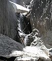 Little Falls on June 1, 2008
 -
 Entrance and Sign
 -
 A hiking trail in the mountains.
 -
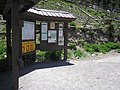
 Forest Service sign at the Visitor center


