Tiszaszőlős: Difference between revisions
Content deleted Content added
m robot Adding: eo:Tiszaszőlős |
change to svg coat of arm |
||
| (29 intermediate revisions by 19 users not shown) | |||
| Line 1: | Line 1: | ||
{{Use dmy dates|date=November 2018}} |
|||
{{Infobox |
{{Infobox settlement <!--more fields are available for this Infobox--See Template:Infobox settlement--> |
||
|settlement_type = |
|settlement_type = Village |
||
|subdivision_type = [[Countries of the world|Country]] |
|subdivision_type = [[Countries of the world|Country]] |
||
|subdivision_name = {{HUN}} |
|subdivision_name = {{HUN}} |
||
|coordinates = {{coord|47|33|35|N|20|43|10|E|region:HU|display=inline,title}} |
|||
|image_shield=HUN Tiszaszőlős COA.svg |
|||
|latd= |latm= |lats= |latNS=N |
|||
|longd= |longm= |longs= |longEW=E |
|||
<!--If coordinates are filled in above remove ed notes from "Hungary" in pushpin_map field to display map--> |
<!--If coordinates are filled in above remove ed notes from "Hungary" in pushpin_map field to display map--> |
||
|pushpin_map = |
|pushpin_map = Hungary |
||
|pushpin_label_position = <!-- the position of the pushpin label: left, right, top, bottom, none --> |
|pushpin_label_position = <!-- the position of the pushpin label: left, right, top, bottom, none --> |
||
|pushpin_map_caption = |
|pushpin_map_caption = |
||
|pushpin_mapsize = |
|pushpin_mapsize = |
||
|timezone=[[Central European Time|CET]] |
|timezone=[[Central European Time|CET]] |
||
|utc_offset=+1 |
|utc_offset=+1 |
||
|timezone_DST=[[Central European Summer Time|CEST]] |
|timezone_DST=[[Central European Summer Time|CEST]] |
||
|utc_offset_DST=+2 |
|utc_offset_DST=+2 |
||
| ⚫ | |||
| |
|||
| ⚫ | |||
| ⚫ | |||
| ⚫ | |||
| ⚫ | |||
|subdivision_type2=[[Districts of Hungary|District]] |
|||
| ⚫ | |||
|subdivision_name2=[[Tiszafüred District|Tiszafüred]] |
|||
area_total_km2= |
|area_total_km2= |
||
population_as_of= |
|population_as_of=2015 |
||
population_total=1730| |
|||
|population_total=1616<ref name="HunStat2015">''[http://www.ksh.hu/apps/shop.kiadvany?p_kiadvany_id=81322&p_temakor_kod=KSH&p_session_id=800051036609396&p_lang=EN Gazetteer of Hungary, 1 January 2015]''. Hungarian Central Statistical Office. 3 September 2015</ref> |
|||
population_density_km2= |
|population_density_km2= |
||
postal_code_type=[[Postal code]] |
|postal_code_type=[[Postal codes in Hungary|Postal code]] |
||
postal_code=5244 |
|postal_code=5244 |
||
| ⚫ | |||
|area_code_type=[[Telephone numbers in Hungary|Area code(s)]] |
|||
| ⚫ | |||
}} |
}} |
||
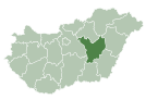
[[Image:JaszNagykunSzolnokCounty.gif|thumb|right|300px|Location of [[Jász-Nagykun-Szolnok]] county in [[Hungary]]]] |
|||
'''Tiszaszőlős''' is a [[village]] in [[Jász-Nagykun-Szolnok]] county, in the [[Northern Great Plain]] [[region]] of central [[Hungary]]. |
'''Tiszaszőlős''' is a [[village]] in [[Jász-Nagykun-Szolnok]] county, in the [[Northern Great Plain]] [[region]] of central [[Hungary]]. |
||
==Geography== |
==Geography== |
||
It has a [[population]] of |
It has a [[population]] of 1616 people as of (2015).<ref name="HunStat2015"/> |
||
[[File:Tiszaszőlős légifotó.jpg|300px|thumb|left|Tiszszőlős - church from above]] |
|||
==References== |
|||
| ⚫ | |||
{{reflist}} |
|||
==External links== |
|||
| ⚫ | |||
* [http://www.tiszaszolos.hu/ Official site] in Hungarian |
|||
{{Tiszafüred District}} |
|||
{{coor title dm|47|37|N|20|46|E|region:HU_type:city}} |
|||
| ⚫ | |||
| ⚫ | |||
{{authority control}} |
|||
[[eo:Tiszaszőlős]] |
|||
[[hu:Tiszaszőlős]] |
|||
{{DEFAULTSORT:Tiszaszolos}} |
|||
| ⚫ | |||
| ⚫ | |||
Latest revision as of 18:07, 18 January 2024
Tiszaszőlős | |
|---|---|
Village | |
| Coordinates: 47°33′35″N 20°43′10″E / 47.55972°N 20.71944°E | |
| Country | |
| County | Jász-Nagykun-Szolnok |
| District | Tiszafüred |
| Population (2015) | |
| • Total | 1,616[1] |
| Time zone | UTC+1 (CET) |
| • Summer (DST) | UTC+2 (CEST) |
| Postal code | 5244 |
| Area code(s) | (+36) 59 |
Tiszaszőlős is a village in Jász-Nagykun-Szolnok county, in the Northern Great Plain region of central Hungary.
Geography[edit]
It has a population of 1616 people as of (2015).[1]

References[edit]
- ^ a b Gazetteer of Hungary, 1 January 2015. Hungarian Central Statistical Office. 3 September 2015
External links[edit]
- Official site in Hungarian


