Ďumbier
| Ďumbier | ||
|---|---|---|
|
Ďumbier (right) |
||
| height | 2043.4 m nm | |
| location | Slovakia | |
| Mountains | Low Tatras , Carpathian Mountains | |
| Coordinates | 48 ° 56 '6 " N , 19 ° 38' 38" E | |
|
|
||
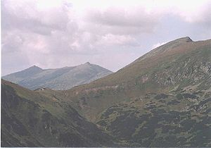
The Ďumbier (German rarely Djumbier , Hungarian Gyömbér ) is the highest point in the Low Tatras with 2043.4 meters .
Under the summit which is the Ďumbier to 1727.9 meters Milan Rastislav Stefanik- - shelter ( Slovak : Chata Milana Rastislava Štefánika). This refuge was built to commemorate the battles between Slovak partisans and German troop units at the end of the Second World War .
The Ďumbier is part of the Slovak Low Tatras National Park. It is also eponymous for the western part of the Low Tatras called Ďumbierske Tatry .
reachability
The Ďumbier can only be reached on foot. From the north there are hiking trails from the Jasná ski resort in Demänovská Dolina and from Liptovský Ján in the neighboring valley. From the south, the summit can be reached from the Trangoška and Srdiečko bus stations .
The European long-distance hiking trail E8 runs in an east-west direction over the Ďumbier, also known locally as the Memorial Trail to the Slovak National Uprising .


