A18 road
| A18 road in the UK | |

|
|
| map | |
| Basic data | |
| Operator: | |
| Start of the street: | Doncaster |
| End of street: | Ludborough |
| Overall length: | 95.5 km (59.3 mi ) |
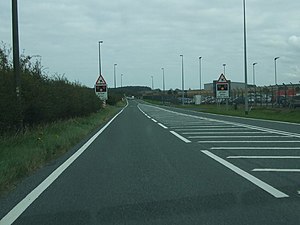
| A18 at Humberside Airport (photo 2009) | |
The A18 road ( English for road A18 ) is a trunk road in England that has only been designated as a primary route for a few sections , which ends from Doncaster essentially parallel to the M180 motorway to Ludborough and there on the A16 road . With the opening of the M180, it has largely lost its national importance.
course
The road begins in Doncaster, is designated as the primary route to Edenthorpe, then runs to the northeast and crosses the M18 motorway beyond Hatfield , which is reached via junction 5 of the M180 motorway , which branches off shortly thereafter , and runs north of the M180 to the east Scunthorpe . The passage through this town from the end of the short M181 motorway to the confluence of the A159 road coming from Gainsborough is again a primary route. In the further course to the east, the A15 road coming from the south joins , then the A180 is crossed and the road leads through Brigg , further east the A15 branches off again to the north and passes Humberside Airport . It continues via Great Limber and Keelby , crosses the A1173 road and from then on is again a primary route. At Laceby the A46 road is crossed, which leads east to Grimsby . The final stretch of the A18 runs through North East Lincolnshire to Ludborough, where the road ends at the A16 road .


