Adobe Creek (San Francisco Bay)
|
Adobe Creek San Antonio Creek, Yeguas Creek |
||
|
Broken sequoia tree in Adobe Creek, Los Altos , California |
||
| Data | ||
| Water code | US : 217989 | |
| location |
United States California |
|
| River system | Adobe Creek | |
| Drain over | Palo Alto Flood Basin → San Francisco Bay | |
| Headwaters | Black Mountain (near Los Altos, California) in the Santa Cruz Mountains 37 ° 19 ′ 12 ″ N , 122 ° 9 ′ 19 ″ W |
|
| Source height | 792 m | |
| muzzle | Palo Alto Flood Basin in the southwestern San Francisco Bay Coordinates: 37 ° 27 ′ 10 ″ N , 122 ° 5 ′ 29 ″ W 37 ° 27 ′ 10 ″ N , 122 ° 5 ′ 29 ″ W |
|
| Mouth height | 0 m | |
| Height difference | 792 m | |
| Bottom slope | 35 ‰ | |
| length | 22.9 km | |
| Left tributaries | Middle, West and North Fork Adobe Creek, Moody Creek, Purisima Creek, Robleda Creek, Barron Creek | |
| Medium-sized cities | Palo Alto | |
| Small towns | Los Altos Hills , Los Altos | |
|
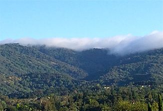
Fog on Black Mountain, the headwaters of Adobe Creek. |
||
The Adobe Creek is a 22.9 km long tributary of the San Francisco Bay . It runs through the towns of Los Altos Hills , Los Altos and Palo Alto . Its name is derived from the Spanish and English word adobe , which means adobe . Adobe Creek is namesake of Adobe Inc.
Individual evidence
- ↑ a b U.S. Geological Survey. National Hydrography Dataset high-resolution flowline data. The National Map , visited on March 15, 2011
- ↑ Frank Heiniger: Adobe wants to grow strongly. In: Finance and Economy . July 31, 2010, accessed June 26, 2017 .

