Aguas Calientes (Peru)
| Machupicchu Pueblo | ||
|---|---|---|
|
|
||
| Coordinates | 13 ° 9 ′ S , 72 ° 31 ′ W | |
| Basic data | ||
| Country | Peru | |
| Cusco | ||
| province | Urubamba | |
| ISO 3166-2 | PE-CUS | |
| District | Machupicchu | |
| height | 2060 m | |
| Residents | 4525 (2017) | |
| politics | ||
| mayor | Darwin Baca León (2019-2022) |
|
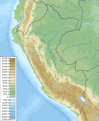
Aguas Calientes , also Machupicchu pueblo , is a small town with 4525 inhabitants (2017 census) in the Andes of South American Peru . The city is located in the river valley of the Río Urubamba at an altitude of about 2060 m . It is the administrative seat of the Machupicchu District of Urubamba Province .
Aguas Calientes is about one and a half kilometers from Machu Picchu and is the starting point for visiting this Unesco World Heritage Site . The place, surrounded by steep walls of rock and cloud forest, can only be reached via a narrow-gauge railway from Cusco , there is no road connection. While most tourists only use this part of the Peruvian Southern Railway (Ferrocarril del Sur) as far as Aguas Calientes, the tracks continue to Quillabamba . The construction of the 914 millimeter line began in 1913, and the rails to Aguas Calientes were not laid until 15 years later .
Thermal springs above the town gave its name to Aguas Calientes (German: 'warm water'). A museum provides information about the archaeological excavations in Machu Picchu and the Inca culture.


