Aguiar de Sousa
| Aguiar de Sousa | ||||||
|---|---|---|---|---|---|---|
|
||||||
| Basic data | ||||||
| Region : | Norte | |||||
| Sub-region : | Porto metropolitan area | |||||
| District : | postage | |||||
| Concelho : | Paredes | |||||
| Coordinates : | 41 ° 8 ′ N , 8 ° 27 ′ W | |||||
| Residents: | 1631 (as of June 30, 2011) | |||||
| Surface: | 22.38 km² (as of January 1, 2010) | |||||
| Population density : | 73 inhabitants per km² | |||||
| Postal code : | 4585 | |||||
| politics | ||||||
| Mayor : | Luís Alberto Costa Teixeira | |||||
| Address of the municipal administration: | Junta de Freguesia de Aguiar de Sousa Lugar de Senande 4585-001 Aguiar de Sousa |
|||||
Aguiar de Sousa is a municipality in the district of Paredes of the district of Porto in Portugal . The city has 1631 inhabitants (as of June 30, 2011).
geography
The municipality is located in the rocky, green landscape that is characterized by the valleys of the Douro and Sousa rivers .
history

The place played a role in the Reconquista , as evidenced by the remains of the castle tower ( Torre dos Castelo de Aguiar de Sousa ) that can be visited . Almansor attacked the fortress in 995, which was subsequently developed into an important point of the defense lines against the Moors . The castle remains are now a listed part of the route along the Roman excavations in Portugal, the Rota do Românico .
Since the independence of the Kingdom of Portugal in 1139, the municipality was a separate district ( concelho ) until the administrative reform in 1855, and has been part of the Paredes district since then.
Surname
Already known at the time of the Roman siege, its name goes back to aquilare or aquilaris , due to the numerous eagles (Latin: Aquila) that were found here at that time . The nearby river Rio Sousa was the second namesake.
traffic
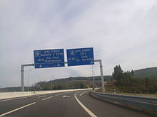
The municipality is located on the A41 motorway , with its own connection.
The nearest railway connection is the train station in Paredes, on the Linha do Douro .
Web links
Individual evidence
- ↑ a b www.ine.pt - indicator resident population by place of residence and sex; Decennial in the database of the Instituto Nacional de Estatística
- ↑ Overview of code assignments from Freguesias on epp.eurostat.ec.europa.eu
- ↑ www.monumentos.pt , accessed on October 19, 2012
- ↑ www.rotadoromanico.com ( Memento of July 17, 2018 in the Internet Archive ), accessed on October 19, 2012
- ^ João Fonseca: Dicionário do Nome das Terras. 2nd edition, Casa das Letras, Cruz Quebrada 2007, page 14 ( ISBN 978-972-46-1730-5 )
- ↑ www.origens.pt ( Memento of August 8, 2014 in the Internet Archive ), accessed on October 19, 2012


