
Paredes
| Paredes | ||||||
|---|---|---|---|---|---|---|
|
||||||
| Basic data | ||||||
| Region : | Norte | |||||
| Sub-region : | Porto metropolitan area | |||||
| District : | postage | |||||
| Concelho : | Paredes | |||||
| Coordinates : | 41 ° 12 ′ N , 8 ° 20 ′ W | |||||
| Residents: | 86,854 (as of June 30, 2011) | |||||
| Surface: | 156.74 km² (as of January 1, 2010) | |||||
| Population density : | 554 inhabitants per km² | |||||
| Paredes district | ||||||
|
||||||
| Residents: | 86,854 (as of June 30, 2011) | |||||
| Surface: | 156.74 km² (as of January 1, 2010) | |||||
| Population density : | 554 inhabitants per km² | |||||
| Number of municipalities : | 18th | |||||
| administration | ||||||
| Administration address: | Câmara Municipal de Paredes Parque José Guilherme 4580-130 Paredes |
|||||
| President of the Câmara Municipal: | Dr. Celso Manuel Gomes Ferreira ( PSD ) | |||||
| Website: | www.cm-paredes.pt | |||||


Paredes is a city in northern Portugal with 87,460 inhabitants (as of June 30, 2011).
history
Excavations show that the area has been settled for over 5,000 years. Since the 2nd century BC The Romans arriving in the 3rd century BC mined gold in the surrounding mines, especially in Castromil.
.jpg)
Today's area around Paredes belonged to Aguiar de Sousa , an administrative district that existed when the Kingdom of Portugal became independent in 1139. At the end of the 16th century, parts of the district administration were moved to Paredes, in particular the hearing room and the prison. Paredes belonged to the municipality of Castelões de Cepeda and was on the road that connected Porto to Vila Real . Four monasteries and various aristocratic families received income from local lands. In the course of the Liberal Revolution of 1822 , the religious orders were expropriated, and in the following administrative reforms, Mouzinho da Silveira created the independent circles of Baltar, Louredo and Sobrosa by splitting off from the Aguiar de Sousa district in 1833/34. In the course of the renewed restructuring by Manuel da Silva Passos , the districts were dissolved again in 1837 and the Paredes district was re-created. In 1844 Paredes was elevated to a small town ( Vila ).
In the second half of the 19th century, the district experienced some economic boom, especially under Mayor José Guilherme Pacheco (1864–1871), who paid particular attention to the district's infrastructure. In addition to improved road connections and the arrival of the railroad, the financially strong returners from Brazil also became a decisive factor in the increasing industrial development, especially in the field of wood processing, and there especially in furniture production, which has remained important to this day.
On June 20, 1991 Paredes was promoted to city ( Cidade ). The continuous growth in the district led in 2003 to the elevation of the places Baltar, Cête, Recarei, Sobreira and Vilela to a city, in addition Gandra, Lordelo and Rebordosa were raised to a small town.
administration
Paredes district
Paredes is the seat of a district of the same name ( concelho ) in the Porto district . On June 30, 2011 the district had 86,854 inhabitants on an area of 156.7 km².
The neighboring areas are (starting clockwise in the north): Paços de Ferreira , Lousada , Penafiel , Gondomar and Valongo .
With the territorial reform in September 2013 , the municipalities ( Freguesias ) Mouriz , Castelões de Cepeda (Paredes), Vila Cova de Carros , Madalena , Besteiros , Gondalães and Bitarães were combined to form the new municipality Paredes . Since then, the district has consisted of the following 18 municipalities:
The following municipalities ( Freguesias ) are in the Paredes district:

| local community | Population (2011) |
Area km² |
Density of population / km² |
LAU code |
|---|---|---|---|---|
| Aguiar de Sousa | 1,631 | 22.38 | 73 | 131001 |
| Astromil | 1,086 | 1.93 | 563 | 131002 |
| Baltar | 4,818 | 7.41 | 650 | 131003 |
| Beire | 2,040 | 3.31 | 617 | 131004 |
| Cete | 3.113 | 4.68 | 666 | 131008 |
| Cristelo | 1,891 | 2.02 | 934 | 131009 |
| Duas Igrejas | 3,879 | 3.78 | 1,026 | 131010 |
| Gandra | 6,974 | 11.76 | 593 | 131011 |
| Lordelo | 10,025 | 9.76 | 1,027 | 131013 |
| Louredo | 1,514 | 2.89 | 523 | 131014 |
| Parada de Todeia | 1,848 | 3.49 | 529 | 131017 |
| Paredes | 19,834 | 21.51 | 922 | 131025 |
| Rebordosa | 9.106 | 10.76 | 846 | 131018 |
| Recarei | 4,631 | 14.60 | 317 | 131019 |
| Sobreira | 4,300 | 21.96 | 196 | 131020 |
| Sobrosa | 2,641 | 4.70 | 562 | 131021 |
| Vandoma | 2,363 | 5.12 | 461 | 131022 |
| Vilela | 5,160 | 4.68 | 1.102 | 131024 |
| Paredes district | 86,854 | 156.74 | 554 | 1310 |
Population development
| Population in Paredes County (1849–2011) | ||||||||
|---|---|---|---|---|---|---|---|---|
| 1849 | 1900 | 1930 | 1960 | 1981 | 1991 | 2001 | 2011 | |
| 17,286 | 20,911 | 26,304 | 43,388 | 67,693 | 72,999 | 83,376 | 86,992 | |
Municipal holiday
- Monday after the third Sunday of July
Town twinning
City partnerships exist between Paredes and
-
 Seichamps in Lorraine , France
 -
Montereau-Fault-Yonne in the Île-de-France , France
economy
With the arrival of the railroad and new roads in the second half of the 19th century, the district developed increasingly industrial. After the independence of Brazil in 1822 and after the end of the Brazilian Empire with the proclamation of the republic in 1891, numerous Portuguese emigrants returned to their home regions, especially in northern Portugal, including Paredes. The often very wealthy returnees ensured a further boost in development, especially through their investments and business start-ups, especially in the furniture manufacturing sector. They invested in existing and newly founded companies, such as the well-known wood processing company A Boa Nova . To this day, wood processing and especially furniture manufacture is an important pillar of the local economy. Paredes County is responsible for around 65% of Portuguese furniture production.
This history is also reflected in tourism and sports in the district. So the themed route Rota dos Móveis (Route of Furniture) was set up, which between 2000 and 2010 also gave its name to the cycling team from the community of Rebordosa, today's LA Aluminios-Antarte team .

traffic
The Linha do Douro railway crosses the district, and there are other stops in the district next to Paredes station.
Paredes has its own exit on the A4 motorway . In addition, the A41 motorways (exit Aguiar de Sousa) and A42 cross the district.
Local public transport is ensured by bus routes. The three private bus companies Valpi Bus, Auto Viação Pacense and Rodonorte operate on various local and regional lines, some of which have a municipal concession.
sons and daughters of the town
- João Gomes Ferreira (1851 in Aguiar de Sousa -1897 in Panaji / India), missionary, bishop of Kochi (India)
- António Barbosa Leão (1860 in Parada de Todeia -1929 in Porto), Bishop of Porto
- Joaquim Alves Correia (1886 in Aguira de Sousa -1951 in Pittsburgh / USA), clergyman, activist of the Catholic opposition against dictator Salazar
- José Manuel Ribeiro da Silva (1935 in Lordelo -1958), cyclist, winner of the Tour of Portugal in 1955 and 1957
- Joaquim Augusto da Silva Mendes (* 1948 in the parish of Castelões de Cepeda ), religious priest and auxiliary bishop
- Jaime Pacheco (* 1958), former soccer player, coach
- Nuno Lacerda Lopes (* 1960 in Rebordosa ), architect, university lecturer, theater director and author
- José Mota (* 1964), football player and coach, with Vitória Setúbal since 2012
- Rui Barros (* 1965), football player and coach
- Carlos Daniel (* 1970), television journalist
- Daniel Faria (1971 in the parish of Baltar –1999), poet and Catholic theologian
- Cândido Barbosa (born 1974 in the municipality of Rebordosa ), cyclist
- Mário Sérgio Leal Nogueira (* 1981), football player, with Metalurh Donetsk since 2008
- Pedro Manuel Mendes Ribeiro (* 1983), football player
- Artur Jorge Pereira Pacheco (* 1987), football player
- Bruno Miguel Oliveira Costa (* 1987), football player
- Hélder Barbosa (* 1987), football player
- Fábio José Ferreira Pacheco (* 1988), football player
- Rafa Sousa (* 1988 in Cete ), football player

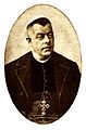
Bishop João Gomes Ferreira
Bishop António Barbosa Leão (1919)

Jaime Pacheco in Beijing (2011)


Web links
- Official website of the city administration (Portuguese, Spanish and English)
Individual evidence
- ↑ a b c www.ine.pt - indicator resident population by place of residence and sex; Decennial in the database of the Instituto Nacional de Estatística
- ↑ a b Overview of code assignments from Freguesias on epp.eurostat.ec.europa.eu
- ↑ igeo.pt
- ↑ a b Local history on the website of the city administration ( Memento of the original from November 6, 2016 in the Internet Archive ) Info: The archive link was inserted automatically and has not yet been checked. Please check the original and archive link according to the instructions and then remove this notice. , accessed February 5, 2014.
- ^ Publication of the administrative reorganization in the Diário da República gazette of January 28, 2013, accessed on March 16, 2014
- ↑ Greetings from the district council ( memento of the original dated November 6, 2016 in the Internet Archive ) Info: The archive link was inserted automatically and has not yet been checked. Please check the original and archive link according to the instructions and then remove this notice. on the city council's website, accessed February 8, 2014.

Amarante | Baião | Felgueiras | Gondomar | Lousada | Maia | Marco de Canaveses | Matosinhos | Paços de Ferreira | Paredes | Penafiel | Postage | Póvoa de Varzim | Santo Tirso | Trofa | Valongo | Vila do Conde | Vila Nova de Gaia