Castelões de Cepeda
| Castelões de Cepeda | ||||||
|---|---|---|---|---|---|---|
|
||||||
| Basic data | ||||||
| Region : | Norte | |||||
| Sub-region : | Porto metropolitan area | |||||
| District : | postage | |||||
| Concelho : | Paredes | |||||
| Coordinates : | 41 ° 12 ′ N , 8 ° 20 ′ W | |||||
| Residents: | 8746 (as of June 30, 2011) | |||||
| Surface: | 3.28 km² (as of January 1, 2010) | |||||
| Population density : | 2666 inhabitants per km² | |||||
| Postal code : | 4580-193 | |||||
| politics | ||||||
| Mayor : | Francisco Augusto Ferreira | |||||
| Address of the municipal administration: | Junta de Freguesia de Castelões de Cepeda Avenida da República, nº 3 4580-193 Castelões de Cepeda |
|||||
| Website: | www.freg-casteloescepeda.pt | |||||
Castelões de Cepeda is a municipality ( freguesia ) in the Portuguese district of Paredes . It has a population of 8,746 (as of June 30, 2011). It represents the local parish of the city of Paredes.
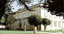
The most important monuments of the municipality include a number of buildings from the 16th century, when the administration of what was then Aguiar de Sousa district was partially relocated here. In addition to public buildings and sacred buildings, these include the pelourinho from the 18th century, mansions , a medieval bridge and the train station from 1875. The historic town center is also a listed building as a whole.
Web links
Individual evidence
- ↑ a b www.ine.pt - indicator resident population by place of residence and sex; Decennial in the database of the Instituto Nacional de Estatística
- ↑ Overview of code assignments from Freguesias on epp.eurostat.ec.europa.eu
- ↑ www.monumentos.pt , accessed on February 8, 2014


