Ahrenshagen (Kuchelmiß)
Coordinates: 53 ° 41 ′ N , 12 ° 19 ′ E
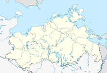
Ahrenshagen is a district of the municipality of Kuchelmiß in the Rostock district in Mecklenburg-Western Pomerania ( Germany ).
geography
The place Ahrenshagen lies in the center of Mecklenburg-Western Pomerania between Kuchelmiß and Krakow am See . The Nebel , which is designated as a nature reserve in this area, flows north to Güstrow . The Ahrenshäger See nature reserve is located about 2.5 kilometers to the south-west on the border with the municipality of Krakow am See .
The built-up location is about 35 to 50 m above sea level. NHN .
history
In the early 12th century, Ahrenshagen was founded as the "Eagle Garden" by Saxon settlers. The place was first mentioned in a document in 1295.
Attractions
In Ahrenshagen there is a classical manor house from 1817. The manor house includes a stables , barns and stables , as well as a park behind the house. The building was built by a family who descended from the Mecklenburg noble family Levetzow .
traffic
Ahrenshagen is connected to the federal highway 103 in Blechernkrug and the federal highway 19 (junction Krakow in Kuchelmiß) via the state road 11 ( Kühlungsborn - Teterow ) .
The next train station with regular passenger transport is in Lalendorf .
Web links
- Places in MV - Ahrenshagen , as seen on May 31, 2011
- Ahrenshagen (Kuchelmiß) in the street catalog , seen on May 31, 2011
