Alberton (South Africa)
| Alberton | ||
|---|---|---|
|
|
||
| Coordinates | 26 ° 14 ′ 0 ″ S , 28 ° 8 ′ 0 ″ E | |
| Basic data | ||
| Country | South Africa | |
| Gauteng | ||
| metropolis | Ekurhuleni | |
| ISO 3166-2 | ZA-GP | |
| height | 1570 m | |
| surface | 77.2 km² | |
| Residents | 121,536 (2011) | |
| density | 1,575.1 Ew. / km² | |
| Website | www.alberton.co.za (English) | |
|
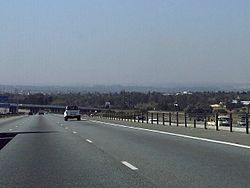
Motorway near Alberton
|
||
Alberton is a city in the South African province of Gauteng about ten kilometers east of Johannesburg . It has been part of the metropolitan municipality of Ekurhuleni since 2000 , in which the previously independent municipalities of the East Rand , the eastern part of the Witwatersrand , were combined. In 2011 the city had 121,536 inhabitants.
history
Alberton emerged in the second half of the 19th century from the farm Elandsfontein of farmer Johan Georg Meyer. He had traded the second half of the farm at a shop in 1886. The neighboring city of Germiston was built there . The city was named at the turn of the century after the hometown of Meyer's ancestors, Prins Albert . By 1905 five families had settled in Alberton; In 1918 the first town hall was built, in 1926 the streets were paved and a post office was opened. In the 1930s and 1940s, the city expanded into the new suburbs of Alberton North , New Redruth , Newmarket and Alrode ; in the 1960s the districts of Alberante and General Albertspark were added. In 1959 the black residents of Elandsfontein were relocated to Thokoza ; In 1971, the quarter in which they lived before became the “white” suburb of Verwoerdpark . In the 1960s there were around 9,000 people in Alberton and around 24,000 in Thokoza.
Web links
- The city Alberton website (English)
Individual evidence
- ↑ 2011 census , accessed October 3, 2013
- ↑ Eric Rosenthal: Gold! Gold! Gold! The Macmillan Company, New York 1970, p. 163
- ^ "The History of Alberton" , webpage of the city of Alberton , viewed on September 5, 2007

